Get Full Government Meeting Transcripts, Videos, & Alerts Forever!
Get email alerts on the Waterfront Planning topic
No spam. Unsubscribe anytime.
Planning director summarizes waterfront land-use plan, growth and coordination with Port
Summary
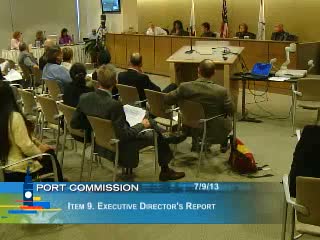
San Francisco Planning Director John Rahm told the Port Commission the Waterfront Land Use Plan and neighborhood plans provide the framework for waterfront development, and that the city is preparing to accept a share of regional growth while protecting maritime industry and public access.
John Rahm, San Francisco's Planning Director, told the Port Commission that existing city planning documents form the basis for waterfront development and interagency coordination. "The waterfront land use plan was adopted in 1997," Rahm said, and it remains the master plan guiding what uses are acceptable across the Port's 7.5-mile waterfront.
Why it matters: The presentation framed the Port's major development sites as part of a regional growth strategy under state law and local planning efforts. Rahm cited the Association of Bay Area Governments' projections and SB 375 as background for why the city is preparing for substantial housing and job growth in areas near the waterfront.
Rahm outlined how neighborhood plans and the waterfront plan work together: they define subdistricts, protect maritime industries, and require public access and urban-design standards. He said the city is being asked to accept roughly 15% of projected regional population and job growth, which the Planning Department translates into targets such as "about 100,000 housing units and several million square feet of new commercial development." The department has been coordinating with the Port, BCDC and the State Lands Commission to align zoning, design guidance and environmental review.
Commissioners pressed on two recurring themes: preserving industrial zoning and addressing climate impacts. Rahm acknowledged tradeoffs in rezoning, noting the city rezoned about half of some industrial areas to allow mixed-use development while retaining maritime priorities where necessary. He also emphasized that waterfront planning now explicitly considers sea-level-rise adaptations and integration with infrastructure projects.
Rahm said the Planning Department has been engaging early with large projects rather than waiting for formal applications, and described an integrated review process with design advisory committees from the Port and BCDC to ensure developments advance both maritime and public-access goals. He closed by urging continued coordination across agencies as large sites such as Pier 70, Seawall Lot 337 and Piers 30'032 move toward implementation.
The commission did not take formal action on policy changes during the meeting; Rahm's presentation served as an informational briefing and set expectations for future interagency coordination and public outreach.