Get Full Government Meeting Transcripts, Videos, & Alerts Forever!
Get email alerts on the Transportation Safety topic
No spam. Unsubscribe anytime.
Calaveras County unveils draft safety plan, cites 356 injuries in 2020–2024 and asks public to mark trouble spots
Summary
Calaveras County presented a draft Comprehensive Safety Action Plan (CASP) funded by USDOT’s Safe Streets and Roads for All (SS4A) grant, reviewed 2020–2024 collision data that identified high‑injury corridors in District 3, and launched an interactive map and survey to collect public input.
Calaveras County officials and consultants on a project team presented a draft Comprehensive Safety Action Plan (CASP) and asked residents to use an online interactive map and survey to identify problem intersections and corridors.
"We want to promote slower speeds to create safer roads for all users," said Rutha Jeriwala, principal at TJKM and the project manager for the CASP, during the presentation. Jeriwala said the county is developing the plan with funding from the U.S. Department of Transportation’s Safe Streets and Roads for All (SS4A) grant program.
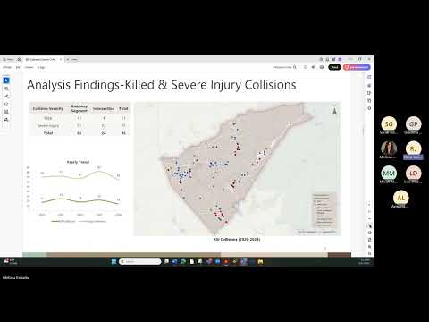
The presenters said the team analyzed five years of county collision records (2020–2024) for county‑owned corridors and intersections and reported 356 injury collisions in that period. Of those, they identified 96 KSI (killed or seriously injured) collisions — 21 classified as fatal and 75 as severe injury. The team cautioned that the analysis excludes Caltrans‑maintained routes such as SR 4, SR 1226 and SR 49.
Presenters described trends that will shape countermeasures: a weekend and summer increase in collisions, a larger share of crashes on roadway segments than at intersections, and mode patterns led by passenger cars and motorcycles. Motorcycle collisions numbered 69 countywide in the five‑year window; presenters said 72% of motorcycle collisions occurred in daylight, while a portion occurred at night on stretches without street lighting.
District 3 specific findings showed 41 collisions over the same period, with the presenters noting the district accounted for roughly 5% of the county’s fatal collisions and nearly half of collisions classified as visible injury. The team identified 10 high‑injury corridors in the district and named Little John Road, Baldwin Street and Railroad Flat Road as top priorities for further study.
Melissa (senior transportation project manager) demonstrated the project website (safestreets.calaverasgov.us) and the interactive map, which lets users drop markers, select a comment category (walking, bicycling, driving, motorcycling, schools), upload photos and upvote or downvote existing comments. Melissa said public submissions through the map and an accompanying survey will be key inputs when the team develops and prioritizes countermeasures.
Project staff said they will integrate the collision analysis with public input, create a prioritized roster of implementable countermeasures, and seek adoption of the CASP by the Board of Supervisors. An adopted plan, the presenters said, is a prerequisite for pursuing some grant funds. The team expects additional outreach meetings and aims to seek final adoption in 2026.
Next steps listed by presenters include developing collision profiles, testing countermeasure ideas, selecting priority projects and returning to the community for a second round of feedback. "Hearing from you is very, very important for this project," Jeriwala said, urging residents to take the survey and share the interactive map with neighbors.