Get Full Government Meeting Transcripts, Videos, & Alerts Forever!
Get email alerts on the Fema Firm Update topic
No spam. Unsubscribe anytime.
Madras planning commission recommends adoption of updated FEMA flood maps to city council
Summary
The City of Madras Planning Commission voted to recommend a code amendment that would adopt FEMA'updated flood insurance rate maps as the city's effective maps, a change staff says uses newer LIDAR-based mapping and will shift some properties into or out of the floodplain. The commission's recommendation moves the measure to City Council for final action.
The City of Madras Planning Commission voted to recommend that the City Council adopt a code amendment incorporating the Federal Emergency Management Agency'updated flood insurance study and maps into the city's development code.
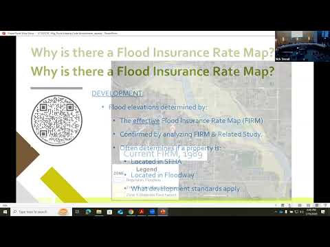
In a staff presentation, planning staffer Nick explained the proposal would remove the specific reference to the 07/17/1989 map and instead make the "effective" FEMA Flood Insurance Rate Map (FIRM) the map that governs local flood hazard regulation. Staff said the update relies on modern mapping (LIDAR supplemented by field surveys) and that most changes in base flood elevation are modest, generally less than one foot in most locations.
The remapping followed a multi-year effort after public concerns about inaccuracies in the 1989 map. Staff said a 2016 Army Corps grant (about $300,000) funded remapping work; the 2018 study found the J Street Bridge was undersized, prompting a bridge expansion completed in 2023. The city submitted a Letter of Map Revision to FEMA in spring 2024 and staff said FEMA has accepted the new study pending local adoption steps.
Commissioners and residents asked how the overlay works and which properties would shift. Staff demonstrated an online map where users can overlay the current and proposed maps and search by address. Staff identified cross-section P with a base flood elevation of 2,251.8 feet and said new construction in affected areas must have finished floors at least one foot above base flood elevation.
Resident Sam Williams asked whether his property near Grizzly and Kincade would be affected; staff said his parcel on the east side of Grizzly Road is outside the mapped floodplain. Other residents asked whether the city planned to alter Willow Creek; staff and the commission said the amendment concerns map adoption and code reference only, not physical changes to the creek or channel realignment.
The commission also discussed practical implications: properties newly placed in the Special Flood Hazard Area (SFHA) could trigger lenders' requirements for FEMA flood insurance, while inclusion in an accurate map gives homeowners the option to obtain subsidized insurance and a clearer path to FEMA assistance after a disaster.
Commissioner Eder moved to recommend the map/code amendment to the City Council; the motion was seconded and passed on a unanimous voice vote. The staff record identifies Feb. 28 as the upcoming City Council public hearing on the map; the ordinance enacting the related development-code changes would follow after FEMA issues a new effective map.
What happens next: the Planning Commission'recommended package goes to the City Council for a public hearing. If the council endorses the change and FEMA finalizes the map, affected property owners will see their status on the city's online mapper and may face new requirements for construction elevation and, in some cases, mandatory flood insurance.