Get Full Government Meeting Transcripts, Videos, & Alerts Forever!
Get email alerts on the Comprehensive Plan topic
No spam. Unsubscribe anytime.
Norman council continues review of AIM plan; staff proposes reducing urban‑reserve minimum from 30 to 10 acres
Summary
Planning staff proposed removing the AIM Norman plan’s 30‑acre urban‑reserve minimum and adding 'cluster development' language to allow 2‑acre lots via planned unit developments, while identifying map corrections and a turnpike alignment update; staff will draft final language and agendize the item for future action.
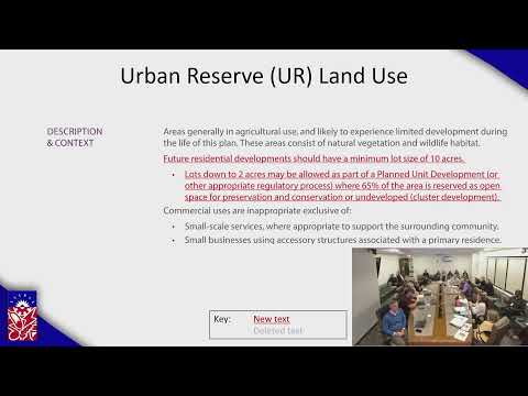
Bora Hoggett, with the City of Norman planning department, told the City Council on Jan. 27 that staff recommends amending the AIM Norman comprehensive plan to replace the urban‑reserve minimum of 30 acres with a 10‑acre minimum and to add 'cluster development' language to the agricultural‑residential category. "We would propose adding the term cluster development in a couple of places in AR," Hoggett said, and described a PUD option that would allow 2‑acre lots on part of a tract while leaving roughly 65% as open space.
Councilor Dixon said he worried lowering the minimum from 30 to 10 acres could allow more division of rural land. "I thought there was a lot of pressure to that we don't want development out there, and this seems like it's allowing more development," Dixon said; staff replied that the plan’s contiguity and character‑area requirements mean development must tie to existing urban services, which limits leapfrog growth.
Councilman Renaud Flair said several constituents in his ward contacted him after the plan’s adoption, asking to preserve the ability to split family land into 10‑acre parcels to pass to heirs. "We didn't know this was coming through," Renaud Flair said, arguing some residents would have objected had they known the stricter standard was adopted.
Staff also flagged several map and mapping‑table errors that need correction. Hoggett said the steering committee voted to show the proposed turnpike alignment on all maps and requested maps be updated to match the most current alignment from OTA. She also noted an error around the Chautauqua Historic District where the map shows "urban medium" despite a prior steering‑committee vote to set that area as "urban low."
Councilors and staff discussed legal and implementation limits. The council explored whether existing owners could be grandfathered under a 10‑acre rule and whether deed transfers could be used to revert parcels to a 30‑acre standard on sale; staff cautioned this raised legal complexity. "They don't give us notice when they file deeds," Beth McCullough, the city’s assistant city attorney, said, underscoring practical enforcement limits tied to courthouse deed records.
Participants also corrected arithmetic on the record about how many lots a landowner could create under different scenarios; staff said they would return with finalized language and the council asked that the item be agendized for formal action. No formal motion or vote occurred at this meeting.
The next step is for planning staff to draft final wording for the proposed AIM plan and subdivision regulation changes and bring that language back to the council for formal consideration and any required public hearings.