County briefing urges residents to prepare for wildfires, debris flows and earthquakes
Get AI-powered insights, summaries, and transcripts
Subscribe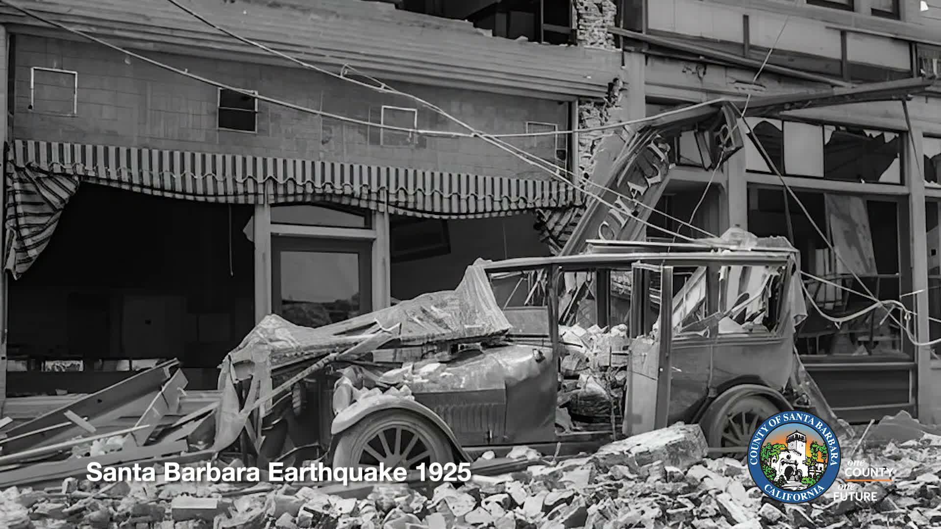
Summary
At a Santa Barbara County hazard briefing, presenters reviewed historic disasters and increasing risks tied to wildfire burn scars and sundowner winds, and urged residents to register for alerts at readysbc.org and check evacuation-zone maps.
Presenters at a Santa Barbara County hazard briefing reviewed the region's history of earthquakes, wildfires and flood-related debris flows and urged residents to take preparedness steps.
Speaker 2, an unidentified presenter, cited historical damage from seismic and flood events, saying, "In 1925, Santa Barbara County experienced an estimated 6.8 earthquake, which damaged or destroyed 600 buildings." He also recalled a past Montecito debris flow that "took 23 of our community members' lives" as an example of the county's longstanding vulnerability.
Speaker 3, an unidentified presenter, described how topography shapes local weather patterns and wildfire behavior, noting the role of the San Ynez Range and "sundowner" downslope winds in creating fast-moving, dangerous fire conditions. He warned that when vegetation is lost to fire, "there's gonna be greater runoff. Doesn't take as much rainfall or rain intensity, but every time there's a burn scar, those areas are gonna be much more at risk for significant flooding and debris flow."
The briefing cited a benchmark fast-moving 1990 wildfire that jumped U.S. 101 and affected urbanized areas of the South Coast and referenced more recent large fires, including the Thomas Fire, to illustrate how both timing and wind patterns influence fire risk.
Speaker 2 said the county uses its hazard mitigation plan and a climate vulnerability assessment to track changing risks and that the Emergency Operations Center brings partners together "to bring everyone together, sharing information, making sure we have a consistent message that supports the community." He closed by urging practical steps for residents: "It is so important that community members consider registering for alerts at readysbc.org. Go to our website. Check out our new evacuation zones map. Know where you are in the community."
The presenters recommended that households identify multiple evacuation routes and neighbors who may need assistance during an event. No formal actions or votes were recorded during the briefing.
The county's hazard mitigation plan and the climate vulnerability assessment were described as the principal planning documents; presenters did not cite specific implementation deadlines or funding amounts during this session.