Get Full Government Meeting Transcripts, Videos, & Alerts Forever!
Get email alerts on the Land Use Development topic
No spam. Unsubscribe anytime.
Residents press Lafayette council to reject or reshape 'The Range' sketch plan amid traffic, height and open‑space concerns
Summary
A large public hearing on the Range at Lafayette sketch plan drew hours of testimony. Residents criticized building heights, parking, traffic and the developer’s proposed public land dedication; councilors largely backed staff requests for more mixed‑use integration, public streets, fewer surface parking spaces and stronger affordable‑housing commitments.
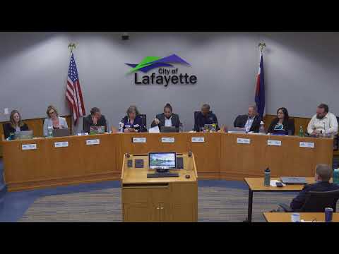
City of Lafayette — The City Council received a lengthy public hearing on a sketch plan for The Range at Lafayette, a 36.24‑acre mixed‑use proposal at the southwest corner of Arapahoe Road and U.S. 287, with developers seeking annexation, zoning and multiple variances.
Planning director Steven Williams, who opened the staff presentation, said the sketch stage is advisory and not a final decision, and listed six topics for council feedback including zoning, comp‑plan alignment, building heights, the commercial/residential mix, housing affordability and public‑land dedication. The applicant, Edgar Crockett of Kensington, described a plan that includes about 448 residential units, approximately 157,000 square feet of commercial space, two committed retail anchors and a commitment that 12% of the multifamily units (41 units) would be deed‑restricted at 80% of area median income.
Why it matters: The site sits in Lafayette’s urban growth boundary and is governed by a 2019 intergovernmental agreement with Erie that calls for comparable anchor tenants on both sides of the highway; it is also planned in the city’s comprehensive plan as “adaptable commercial,” a typology intended to evolve from big‑box retail to mixed‑use, walkable districts. Councilors and residents framed their responses around whether this proposal advances that long‑term vision.
What council and staff said: Staff urged the council to ask the applicant to rework the plan toward the comprehensive‑plan “ultimate” adaptable commercial form: break up large parking blocks with public streets, orient buildings to streets rather than big parking fields, provide more shared parking and integrate commercial uses into building frontages. Williams also noted staff has provided a 16‑page initial comment letter and that engineering studies (traffic, drainage) are not yet complete.
Applicant proposal and claimed benefits: Crockett said the plan balances retail anchors with housing and local open space, and estimated long‑term economic benefits including tax revenue and job creation. The applicant also requested targeted variances to increase heights (proposed 50–60 feet in places versus a typical 35‑foot limit) to make the project financially feasible and to deliver a portion of affordable units.
Public response: Roughly 30 speakers appeared during the hearing. Opponents described the sketch plan as “9‑Mile Corner 2.0,” a repeat of suburban big‑box development and parking‑heavy design that would impede walkability, block mountain views, exacerbate congestion and create evacuation hazards. “This proposal does not align with the Lafayette comprehensive plan nor reflect the character, scale or values of our town,” one speaker said. Several residents urged the council to require the developer to deliver a more compact, green‑centered plan with greater housing diversity and deeper affordability — including for‑sale affordable options — and to move the public gathering spaces away from noisy arterials and out of detention‑pond buffers.
Supportive views: Other testimony acknowledged benefits of transit‑focused density near planned bus rapid transit (BRT) corridors, arguing taller buildings at the arterial corner can be appropriate if linked to frequent transit access and if the project delivers genuine affordable housing and public amenities. A transportation professional told council tall buildings near arterials are acceptable when they make transit viable.
Council direction: Councilors generally supported staff’s technical comments and pressed the applicant to:
- Provide clearer public‑street dedication rather than relying on private drives; - Reduce surface parking and plan for shared parking strategies; - Rework the public‑land dedication so it creates usable civic space rather than a narrow trail or a detention pond labeled as public land; - Explain and justify height requests and provide more gradual transitions to adjacent neighborhoods; and - Increase the scale, depth or AMI target of committed affordable housing and consider deed‑restricted for‑sale units as part of the total affordability calculation.
Next steps: The sketch presentation generated substantial feedback but no entitlement decision; the applicant said it would compile council and public comments and return with more detail in subsequent preliminary PUD submittals, including the required traffic and drainage studies.
Ending: The council left the record open to staff analysis and next‑phase materials; no final votes were taken on the sketch plan during this meeting.