Get Full Government Meeting Transcripts, Videos, & Alerts Forever!
Get email alerts on the Parks And Recreation topic
No spam. Unsubscribe anytime.
Port Richey reviews 3D park charrette; council weighs beach expansion, boat-ramp tradeoffs and pedestrian bridge
Summary
At a Feb. 3 workshop, Port Richey officials and Tampa Bay Regional Planning Council consultants reviewed 3D concepts for four waterfront parks, explored purchasing an adjacent lot to expand Olsner Park, and discussed options for Nick's Park boat-ramp relocation and a pedestrian bridge linking parks to the commercial district. No funding votes were taken.
Port Richey’s Community Redevelopment Agency met Feb. 3 to review a digital charrette — a set of 3D concept plans produced with the Tampa Bay Regional Planning Council — for four waterfront parks and preliminary next steps for engineering and funding.
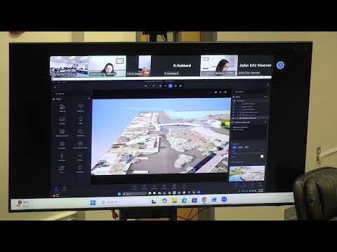
Consultant Sarah Vitale, director of civic technology at the Tampa Bay Regional Planning Council, led the presentation and said the effort aims to turn community workshop feedback into a final, visual report and modeling files that the city can attach to requests for proposals. “We’re here to do a digital charrette,” Vitale told the board, describing site visits, a November workshop and a forthcoming final document scheduled for March.
Why it matters: the park concepts aim to balance everyday waterfront access, resilience to flooding and expanded programming while the city must respect a conservation easement that limits new structures over open water. The charrette targets four parks — Olsner, Nick’s, Brasher and Waterfront Park — and identifies priorities such as shade, restroom improvements, kayak launches, accessible boardwalks and a potential pedestrian bridge that could connect parks to the downtown commercial area.
Key proposals and council direction - Olsner Park: Consultants suggested options to deepen the beach area, replace a deteriorated gazebo with a multiuse shaded structure and reconfigure parking. Councilmembers discussed the possibility of acquiring an adjacent lot (the presenter said it was listed for about $450,000–$500,000) to expand beach area and parking, but noted deed restrictions and flood-mitigation grant rules could limit uses. - Nick’s Park: The team showed a concept that trades some trailer parking for improved waterfront circulation and docks. Board members stressed that Nick’s is the city’s only public boat ramp and urged staff to first confirm potential alternate ramp sites — including a county-proposed ramp across the river — before removing ramp capacity. - Brasher Park: Concepts include a boardwalk, an observation “stilt-house” platform, kayak-launch improvements and improved restrooms and playgrounds. The council discussed resilient materials (synthetic decking, PVC thatch) and whether targeted mangrove trimming is permissible under environmental rules. - Waterfront Park: The draft includes expanded parking, an enlarged dog park, a two-part enclosed playground with a splash pad, a small amphitheater on the hill and additional kayak access. Staff flagged the conservation easement boundary as a constraint on new over-water structures but noted possible stormwater grants that could fund co-benefit features such as a stormwater-integrated amphitheater.
Pedestrian bridge and waterfront connectivity Consultants proposed a pedestrian bridge that would visibly link the waterfront parks to nearby commercial parcels, improving access and creating vantage points. Designers showed a low bridge option (example clearance shown at about 48 feet) and discussed a higher option if boat clearance is required. Board members noted the bridge alignment, clearance and where it would touch shorelines (and any private property or conservation easement areas) will determine feasibility and permitting needs.
Public input and outreach Residents provided detailed, site-specific input during the workshop and public-comment periods. Several speakers urged preserving boat access and fishing opportunities while expanding passive recreation. The consultant said she will accept written feedback through February and deliver the final materials to staff in March so cost estimates and engineering can follow.
Next steps and limits Vitale said the next deliverable will fold tonight’s comments into revised plans and produce modeling files for engineering use. Staff and the board emphasized that the CRA funding timeline will influence priorities and that any acquisition, dredging or new over-water structure will require separate legal and permitting reviews. No formal motions to adopt designs, appropriate funding or change easement boundaries were made at the workshop; the meeting ended with the board thanking the consultants and adjourning.