Get Full Government Meeting Transcripts, Videos, & Alerts Forever!
Get email alerts on the Land Use topic
No spam. Unsubscribe anytime.
Committee reviews existing land‑use inventory, debates how to classify and manage potential solar farms
Summary
Planners presented an existing land‑use inventory covering ~17,000 parcels (excludes the cities of Ashland and Mellon). Committee members pressed on how large ground‑mounted solar farms would be categorized and whether zoning or future land‑use mapping should be used to manage large installations.
Planner staff presented an existing land‑use inventory for Ashland County and answered committee questions about methodology, categories and how the inventory will feed the land‑use chapter.
The presenter said they individually reviewed about 17,000 parcels and assigned categories using aerial imagery, parcel size and statewide parcel value data, noting some parcels were split when partly agricultural and partly forested. "There's about 17,000 parcels that I went over individually to assign a land use to," the planner said, and noted municipal comprehensive‑plan processes will supply their own detailed maps for city areas.
Committee members raised a series of classification and policy questions. One member asked how a large solar farm would be classified under the inventory; the planner answered it would typically be put under "utility," but several members said that answer was not definitive for forward‑looking planning. A committee member observed: "But my understanding is under state rules right now, if someone wants to put 1 in, we can't say no," and urged the committee to consider mapping suitable areas and possible zoning controls rather than relying solely on the existing‑use categories.
The planner emphasized that an existing land‑use map shows what is currently on the ground, while the future‑land‑use map — a required element of the comprehensive plan — is where the county decides what it wants to allow over a 20‑year horizon. Committee members asked for clearer legend colors, cross‑hatching or textures to improve map legibility and accessibility; the planner agreed to adjust colors, check category assignments and follow up after the meeting.
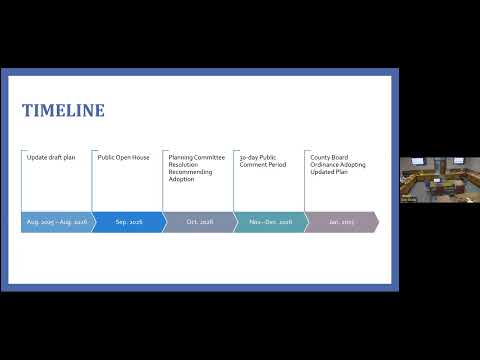
Next steps: Planner will review flagged parcels for category/acreage mismatches, refine the map legend for accessibility, and prepare materials relating to future‑land‑use options (including how renewable energy and large installations might be treated) for a subsequent committee meeting.