Get Full Government Meeting Transcripts, Videos, & Alerts Forever!
Get email alerts on the Environmental Review topic
No spam. Unsubscribe anytime.
Staff outlines mitigation, floodplain and steep‑slope conditions for Willamette View riverfront project
Summary
County planners said the proposal disturbs ~9,764 sq ft of habitat conservation area requiring about 98 trees and 488 shrubs in mitigation, that dock/gangway require a no‑rise certification in the floodplain, and that liquefiable soils mean stamped geotechnical certification will be required for certain structures.
Clackamas County staff provided detailed environmental findings at the Feb. 19, 2026 hearing on Willamette View’s riverfront park proposal, identifying mitigation obligations and specific technical conditions the applicant must meet before development permits are issued.
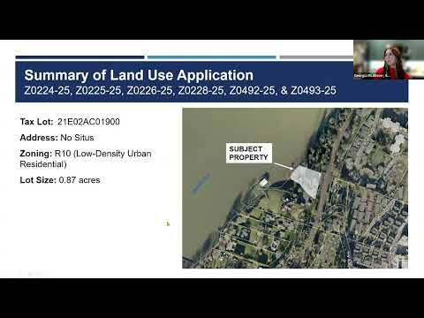
Habitat conservation area: Senior planner Taylor Campy said the site contains high and moderate HCA and that the project would disturb approximately 9,764 square feet. Using the county’s prescribed pathway A methodology, staff calculated mitigation requirements of 98 new trees and 488 new shrubs and reviewed the applicant’s mitigation plan for plant sizing, spacing and allowable locations; the mitigation plan includes native species and spacing details intended to meet code standards.
Floodplain and Greenway: Campy explained the property is within FEMA’s mapped 1% annual chance floodplain and adjacent floodway; docks and gangways are considered water‑dependent uses that can be permitted if accompanied by a no‑rise certification demonstrating no increase to the base flood elevation. Staff noted the gangway attachment point on the shore is shown about 245 feet from mean low water — outside the 150‑foot vegetated buffer the Willamette River Greenway aims to preserve — and that other development is farther from the water.
Steep slopes and geotechnical concerns: The site includes slopes over 20% and areas above 35%, invoking additional review. Campy said the applicant proposes grading and disturbance below the 30% cap on steep slopes (staff estimated the project’s grading would be closer to 15% of steep slope area). The applicant submitted an engineering geologic (geotechnical) report; staff noted that report identified liquefiable soils (site class F) and recommended a condition requiring the applicant to document the fundamental period for each structure. If a structure’s fundamental period exceeds 0.5 seconds, staff said the applicant must provide additional site‑specific seismic hazard evaluation and stamped geotechnical certification showing the site is stable for the proposed development.
Design and mitigation measures: To minimize disturbance, the applicant proposes elevated walkways on pin piles (minimal excavation foundations), a flow‑through planter for stormwater treatment (located within HCA and exempt from HCA counting), native revegetation, tree preservation where feasible, and shielded lighting to reduce off‑site impacts. Staff flagged outdoor storage in HCA as prohibited (including storing kayaks in HCA) and confirmed that paving an existing gravel access is exempt from HCA calculations so long as footprint is not expanded.
Next steps: Staff recommended approval with conditions that include engineering documentation, mitigation monitoring, and compliance with HCA/WUCRA/Greenway requirements; the hearings officer left the record open to 4 p.m. Feb. 19 for additional materials and asked the applicant to submit any revised condition language and sealed engineering documentation before the record closes.