Get Full Government Meeting Transcripts, Videos, & Alerts Forever!
Get email alerts on the Allen Abar Ranch Subdivision topic
No spam. Unsubscribe anytime.
DRC tables Allen Abar Ranch preliminary subdivision amid drainage, hillside overlay and county coordination questions
Summary
The committee recommended tabling the Allen Abar Ranch preliminary subdivision after staff requested hazard‑mitigation study material for the hillside overlay/WUI zone, clarity on building envelopes for steep slopes, and coordination with Utah County on a box‑culvert flood project affecting the site and easements.
The Santaquin DRC on Tuesday tabled the Allen Abar Ranch preliminary subdivision, a proposed development on the south end of 100 West that abuts existing flood‑control infrastructure and the Allen Pond.
Planning staff flagged the parcel as being entirely within the Wildland‑Urban Interface (WUI) and the city's hillside overlay zone, requiring a hazard‑mitigation assessment and specific notes on water runoff and potential flooding. Aspen told the committee that because of the hillside overlay “it will require hazard mitigation assessment that would need to be turned in and then we also think there needs to be a note about water runoff and like potential flooding.”
Members debated historical runoff patterns. One committee member corrected an earlier reference to the “Molly fire,” saying the Williams fire in 2019–2020 was the event that significantly changed runoff from Pole Canyon; the committee asked for hazard and flow estimates in the resubmittal.
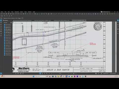
Engineers described coordination with Utah County on a box‑culvert flood project and said the county is the NRCS project sponsor, with the city as a co‑sponsor. The engineering team said the proposed grading and a realigned channel were designed to capture flood flows and to avoid routing water into the public roadway. Staff emphasized that where the plans show realignment over adjacent private property, the applicant will need easements or agreements; otherwise the channel alignment on the plans means little without legal access.
Committee members also asked that the plat clearly show building envelopes and mark unbuildable slopes (locations over 30%) so future owners will know development limits. Norm and other members noted open‑space requirements tied to the hillside overlay (a 10% improved open space rule was discussed) and suggested that the county easement/channel might be folded into an open‑space solution if ownership and maintenance responsibilities are clarified.
After discussing the outstanding items — utility coordination, county easement work, hazard mitigation and the need for clearer building envelopes and plat limits — the DRC moved and seconded a motion to table the preliminary subdivision pending the requested documentation and coordination.
Next steps: staff will work with the county and the developer to reconcile easement and channel details, request hazard‑mitigation flow estimates and require clear plat notation of building envelopes and unbuildable slopes before returning to the DRC.