Get email alerts on the Transportation Safety Plan topic
No spam. Unsubscribe anytime.
CRCOG outlines Vision Zero safety plan, seeks public input through Dec. 3
Summary
CRCOG presented a draft Transportation Safety Action Plan that uses a five‑year crash analysis and community engagement to prioritize projects and countermeasures aimed at eliminating fatal and serious injury crashes by 2040; a two‑week public comment period closes Dec. 3 and the final plan is targeted for early 2026.
Hartford‑region planning officials presented a draft regional Transportation Safety Action Plan and sought public feedback at a public information meeting, outlining a Vision Zero goal of zero fatal and serious‑injury crashes by 2040 and an interim target to cut those crashes 50% by 2032.
Shauna Kitzman, a project lead with the consulting team, opened the meeting and said the team would present crash analysis, engagement findings and proposed project prioritization. "I'm Shauna Kitzman, and I'm happy to welcome everyone to the public information meeting for CROG's transportation safety action plan," she said, and reminded attendees that the two‑week written comment period closes on December 3.
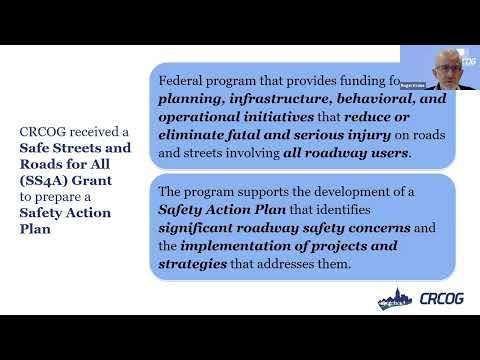
Roger Kron, CRCOG project manager, said the region (38 member municipalities) recorded between 33 and 58 fatalities per year and roughly 254–272 suspected serious injuries during the 2019–2023 study period. He tied the update to the federal Safe Streets and Roads for All (SS4A) program, which funds both plan development and implementation of projects. "This plan was adopted initially back in 2020 ... what we're talking about now is an update," Kron said.
Consultant Christian Mazur described the data methods: five complete years of crash data (2019–2023) from the University of Connecticut Transportation Institute's Crash Data Repository, excluding interstates and expressways. He explained two network analyses used to prioritize locations: a "high‑injury" network that treats fatal and serious injuries equivalently and a "high‑risk" network that weights severities. Mazur said the high‑injury analysis identifies the intersections and roadway miles that together capture 80% of the region's fatal and serious crashes — roughly 2% of intersections and 3% of roadway miles, about 650 intersections and 130 miles in the regional network.
Kitzman summarized extensive engagement: focus groups (including an AARP senior group), table talks, student outreach and bike‑bus events (a Silver Lane bike bus involved about 30 students), a walk audit in New Britain that flagged missing curb ramps and unsafe crossings, a winter pop‑up at Pratt Street in Hartford, and a public map survey that produced roughly 500 pin drops. "Most people, no surprise, are concerned about speeding and aggressive driving, unsafe crossings, and missing bike and ped infrastructure," she said.
On equity and policy, Kron said CRCOG used the USDOT SS4A tool to identify underserved communities and will cross‑reference project locations with those areas. He listed CRCOG documents up for policy review and noted a roundabout screening study as one policy‑level action to consider.
Project selection will combine the regional high‑injury network with municipal priorities gathered through town meetings; Christian said the team will recommend evidence‑based safety countermeasures drawn from FHWA and other resources so nominated projects are competitive for implementation funding.
During the public Q&A, an East Hartford town engineer asked whether the final report and dashboard would clearly separate state and municipal road ownership for funding considerations; Kron said state route numbers will be identified and CRCOG will coordinate with the Connecticut Department of Transportation on letters of support for grant applications. Barbara Modio asked whether the crash analysis isolates right‑turn‑on‑red conflicts at trail crossings such as the Route 6 crossing on the Airline Trail. "The crash data does not show the need to have an overall wide scale ban on right turn on red," Kron replied, while noting Connecticut DOT guidance and a lighted prohibition sign that can be activated by pedestrian signal calls as a targeted mitigation.
A question about e‑bikes and passing etiquette on sidewalks and trails prompted staff to say education and clearer guidance on classes of e‑bikes are part of ongoing discussion. Christian and staff acknowledged smaller towns' staffing and funding limits and said regional shared services and technical assistance are possible ways to support implementation.
CRCOG executive director Matt Hart closed by thanking staff and attendees and urging continued engagement. The public comment window is open for two weeks; the team will post the meeting recording and the crash maps/dashboard online and aims to complete and approve the final Safety Action Plan in early 2026.
AI generated
The text on this page is AI generated. Summaries, highlights, analysis, and video transcripts are all produced from the original source material.
AI can make mistakes, so if you spot one, and we will fix it for everyone.
Note: the source content is unaltered by us. Any content source we link to, be it a video, an audio recording, or a document, is presented exactly as its publisher released it. That publisher is usually a government body, sometimes an individual official or another organisation.