Get Full Government Meeting Transcripts, Videos, & Alerts Forever!
Get email alerts on the Development And Infrastructure topic
No spam. Unsubscribe anytime.
Council debates DRGR land strategy as members cite flood, traffic and revenue risks
Summary
Council members at a Bonita Springs workshop discussed roughly 523 acres of DRGR‑designated land and debated whether to retain local control, noting stormwater and traffic risks and warning that county control could bring higher density and little local benefit.
Council members spent a large portion of the workshop debating DRGR lands — a policy boundary the city established to guide future development — and whether the city should resist approvals, negotiate development agreements, or allow the county to take control of parcels. One council member argued the city should retain jurisdiction "because at least we're driving" approvals and collecting impact fees; another warned that "if you give it over to the county... we get all the intensity and we get none of the benefits."
Staff told the council the DRGR inventory is roughly 523 acres, with an estimate of about one dwelling unit per 10 acres, leaving roughly 52 remaining units available under current designations. Council members requested a parcel‑level breakdown of DRGR lands (owners and parcel counts) to assess how many distinct property owners the city is dealing with.
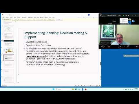
Several councilors said the practical choice often becomes negotiating with developers to "get the best deal we can" rather than holding out, because developers can instead apply to the county. One council member urged a parcel‑by‑parcel approach: evaluate compatibility and potential "unduly" harmful impacts on a case‑by‑case basis rather than a blanket position.
Stormwater and flood risk were recurring themes. Council members referenced damage from Hurricane Irma and multi‑storm events, warning that development, lift stations and drainage changes could push water into the Keel Canal and Imperial River and produce downstream impacts years later. "I look at what happened with Irma... the Keel Canal backed up the Imperial River," one councilor said, urging caution about how water would be moved and where it would be discharged. Council members asked staff to pursue a joint city‑county build‑out and transportation analysis because large portions of the DRGR area are currently under county control and regional impacts (traffic and drainage) cross jurisdictional lines.
The council also discussed workforce‑housing tradeoffs and downtown revitalization as part of the broader planning conversation: some councilors said adding height and density could address housing supply but also create traffic challenges without concurrent regional transportation investments.
Next steps: staff will provide parcel‑level ownership data, additional hydraulic and build‑out analysis, and targeted follow‑up briefings so council members can evaluate individual DRGR parcels with more technical support.