Nonprofit demonstrates STARS tracking system meant to speed oil‑spill response along western Alaska coast
Get AI-powered insights, summaries, and transcripts
Subscribe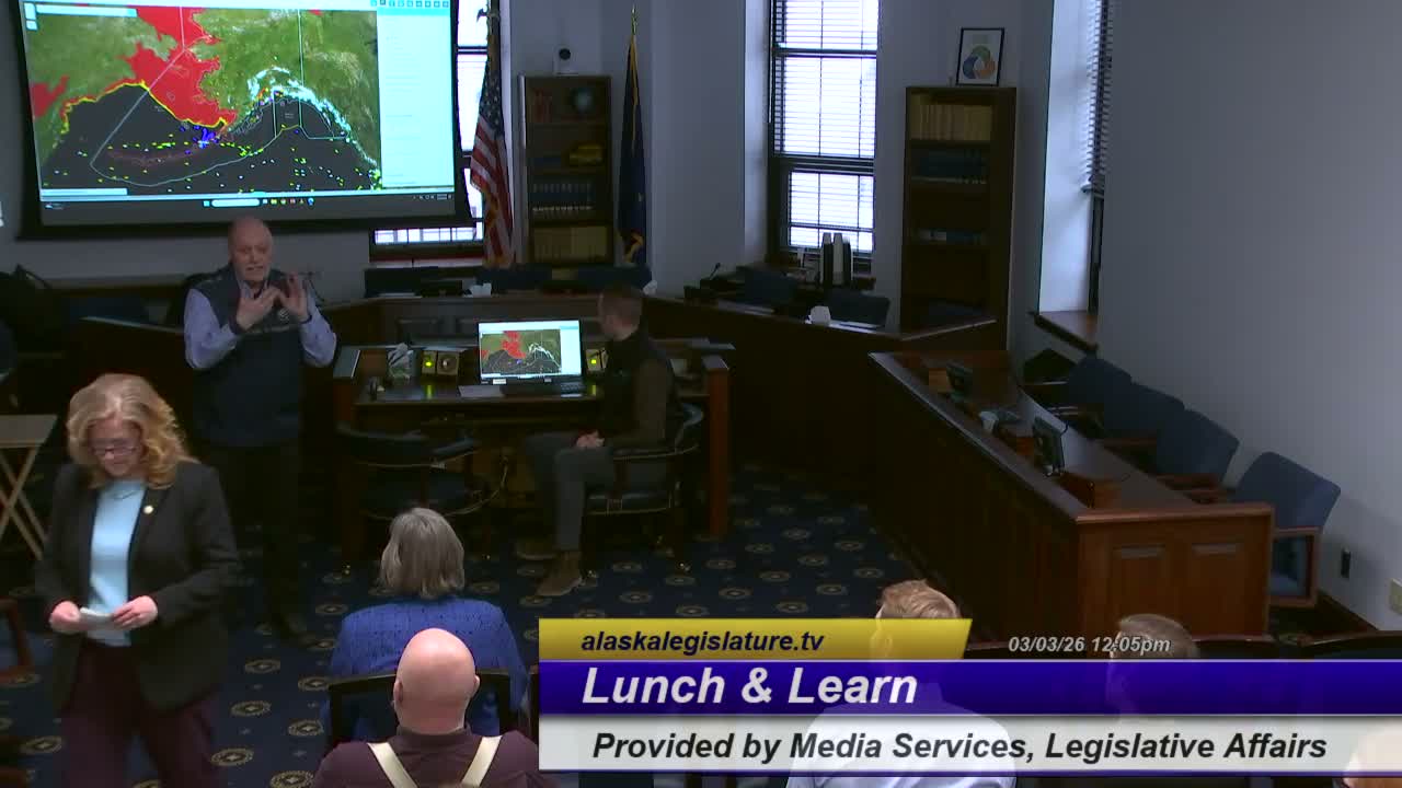
Summary
Marty Kesten and Steven Gableine demonstrated STARS, a live situational‑awareness system that tracks enrolled vessels, maps sensitive areas and caches equipment, and alerts response partners to vessels that slow below 3 knots or report distress.
Marty Kesten, introduced himself as president and chief executive officer of what he called the Elastos Chatto Network and demonstrated a live feed of STARS, the Strategic Tracking, Alerting and Response System, during a county‑district meeting in Alaska. The system, Kesten said, is supported by industry funding and runs a 24/7 monitoring center in Anchorage that fuses AIS satellite and terrestrial data, chart layers and response plans to help detect vessels in distress and preposition response assets.
Kesten said the nonprofit built the system to protect Alaska’s maritime transportation, fisheries and subsistence communities by improving situational awareness. “This is live right now,” he told the audience as his colleague Steven Gableine walked through map layers showing sea ice, fuel‑facility locations and equipment caches. The prerecorded video shown at the start described STARS as “purpose built for Alaska to enhance prevention, strengthen coordination, and improve real time visibility.” (Recorded video narrator.)
Gableine, the customer service manager who helped build the system’s STARS implementation, said the program monitors more than 5,000 enrolled vessels, with a size threshold of roughly 400 gross tons. He described color‑coded vessel icons, 17 equipment response hubs around the state and links from each icon to plan‑holder and inventory details such as onboard fuel amounts and cargo types. “We have over 5,000 vessels,” Gableine said, and each icon links to information that response teams can use.
The presenters said the system flags vessels that meet predefined parameters or show visual anomalies. One automated threshold Gableine described is vessel speed: when an enrolled commercial vessel slows below about 3 knots, the system treats that as a trigger for follow‑up. Watchstanders then contact the vessel to determine whether the slowdown is weather, scheduling or an engine casualty; if a serious issue is suspected, the system elevates notifications to the U.S. Coast Guard, state agencies, marine pilots, salvage and firefighting providers and the vessel’s duty person ashore.
Kesten and Gableine emphasized that STARS is built to integrate multiple data feeds. Gableine said fused AIS plus other data capture vessel contact info, when a vessel entered the coverage area, and estimates of nonpersistent versus persistent fuel onboard. He showed heat maps of incidents over five years and said many incidents cluster near Unimak Pass; the trend maps, he said, help prioritize locations and response tactics.
The presenters acknowledged limits: the system depends on AIS reporting and cannot see vessels intentionally not reporting. Kesten said other agencies use different sensors and satellite analysis to detect nonreporting ships and that STARS is intended to complement those tools rather than replace them. They also said some international shipping rules, for example International Maritime Organization “areas to be avoided,” are voluntary designations that keep some traffic farther offshore (Gableine estimated these buffers at roughly 50 miles offshore) to buy response time.
Kesten said the nonprofit’s model is industry funding rather than subscriptions; agency partners receive access for free during responses, exercises and drills. He said the system helps preposition equipment and responders so a potential grounding can be contained faster than in the past when responses were days away. “We knew what was going on,” Kesten said, describing situations where prepositioned assets reduced uncertainty and sped containment.
Looking forward, Kesten described work with universities to add AI and machine‑learning tools that can model last‑known positions when AIS is lost and suggest search‑and‑rescue patterns. He closed by inviting attendees to visit the Anchorage monitoring center and by saying the system is intended to reduce the risk of major spills: “Let’s prevent things bad from happening,” he said.
The presentation did not put new regulatory requirements before the meeting; it focused on a technology demonstration and on the nonprofit’s coordination role with federal and state response partners. Attendees asked about coverage (the presenters said the system covers Western Alaska and Prince William Sound but not Southeast Alaska, where another provider operates) and about visibility into nonreporting vessels. The presenters offered contact cards and an invitation to view the Anchorage monitoring center after the session.
What happens next: no formal vote or regulatory action was recorded during the presentation; the system operators said they will continue outreach and partner coordination and that agency access is opened as needed during incidents.