Get Full Government Meeting Transcripts, Videos, & Alerts Forever!
Get email alerts on the Data Portal Tools topic
No spam. Unsubscribe anytime.
Census webinar answers users’ top questions on data.census.gov, MDAT and geography selection
Summary
U.S. Census Bureau staff walked users through finding datasets, choosing compatible geographies, downloading and printing tables, and the limits and workflows for the microdata access tool (MDAT). Presenters pointed to documentation, workshops and the webinar recording for follow-up.
The U.S. Census Bureau hosted a recorded webinar to address common user questions about data.census.gov, the microdata access tool (MDAT) and the Census API.
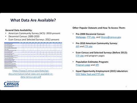
Tyson Weister, a member of the Census Bureau’s communications team in the Center for Enterprise Dissemination, explained that data.census.gov is the Bureau’s primary platform for widely used products, including American Community Survey (ACS) tables, decennial census products and selected economic surveys. “We are the area responsible for data.census.gov, the microdata access tool on data.census.gov, as well as the Census API,” Weister said, outlining the session’s focus on finding data, selecting geographies and downloading or printing results.
Why it matters: users frequently encounter differences across products and geographies that affect what appears in a table or which areas are available. Weister warned that the same table ID can have different layouts depending on the product—for example, table P1 in 2020 redistricting files displays race breakdowns while P1 in the 2020 demographic and housing characteristics product shows only total population—and advised always checking the product dropdown.
Key practical tips
• Searching and topics: Use topic filters for separate searches; selecting multiple topics in a single query typically returns only tables that contain every topic you select. Weister demonstrated examples for veterans and median household income and noted cross-tabulated tables can produce different values than separate single-topic tables.
• Geography selection: Cities are usually classified as “place,” but in some states (notably parts of the Northeast and Midwest) towns may be “county subdivision.” If a geography does not appear, check the summary level tab for dataset-compatible geographies or switch from ACS 1-year (available only for geographies with about 65,000+ people) to ACS 5-year estimates for smaller areas. Weister also recommended the site’s map tab and the address-search (geography pin) to confirm selections visually.
• ZIP codes: For population and housing use ZIP Code Tabulation Areas (ZCTAs); for business patterns use 5-digit ZIP codes to access establishment, payroll and employee counts.
• Downloading and printing: A single download button now groups Excel, CSV and ZIP. Excel and CSV produce presentation-ready tables that reflect on-screen edits; ZIP contains flat machine-readable CSV files with geoIDs. The site’s print button prints only the first table page, so Weister recommended the Excel output for full-table printing.
• MDAT and microdata: MDAT lets users build custom tables when premade tables lack detail, but MDAT’s lowest ACS geography is public use microdata areas (PUMAs), which cover approximately 100,000 people and generally align with counties. MDAT does not compute percentages, medians or margins of error; users must export counts or raw microdata and calculate those statistics offline using their own software. Weister stressed applying suggested survey weights for accurate weighted estimates.
Resources and next steps: The webinar pointed attendees to the notes button on tables for technical documentation, a webpage of upcoming releases (including ACS 1-year and 5-year releases), monthly free workshops on mapping, MDAT and the API, and usability testing opportunities. The session recording will be posted and follow-up questions may be sent to census.data@census.gov or census.askdata@census.gov.
The webinar concluded with a brief evaluation survey for attendees and contact guidance for media inquiries to pio@census.gov.