Lifetime Citizen Portal Access — AI Briefings, Alerts & Unlimited Follows
Paradise holds CEQA scoping meeting for Southeast evacuation route amid split public reaction on property impacts and bike lanes
Loading...
Summary
Town staff presented revised alignments, reduced corridor width and funding plans for the Southeast Paradise Evacuation Route Project; public commenters split between safety advocates who cited the 2018 Camp Fire and residents concerned about property loss, privacy and traffic; formal comments are due March 25.
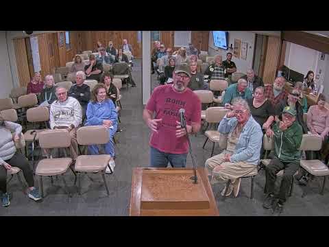
Town of Paradise public works staff presented revised alternatives, funding and a schedule for the Southeast Paradise Evacuation Route Project at a public CEQA scoping meeting, and then opened the floor to residents for a two-hour listening session. Staff emphasized that no preferred alternative or final decision has been made and that written comments submitted by March 25 will be part of the formal environmental record.
Mark Maddox, the town’s public works director and town engineer, described the project as a phased effort to improve east–west connectivity in south Paradise, eliminate dead-end roadway gaps and provide additional evacuation and emergency access after the 2018 Camp Fire. He told the room the revised corridor cross-section was narrowed from a 42-foot section to a 36-foot section with two 12-foot travel lanes and 6-foot bike lanes/shoulders, and that the earlier proposed shared-use multiuse path on one side was removed following public feedback. Maddox said Phase 1A is an approximately half‑mile connector intended to improve access between South Libby, Sawmill and Edgewood; Phase 2 would extend connections toward Clark Road and could require longer bridge work depending on alignment choices.
Staff outlined funding sources and estimated costs: Phase 1A is funded primarily through HUD Community Development Block Grant disaster recovery funds and a congressional earmark with an estimated cost range of about $7.7 million to $9.1 million; Phase 2 includes a secured $33 million award from a state transportation climate adaptation program and a broader Phase 2 cost range cited at about $41 million to $61 million (staff said figures are escalated to expected construction years). Staff also listed environmental resources to be studied, announced right‑of‑entry letters to property owners aimed to be mailed by 2026‑04‑08 for noninvasive field surveys, and said field surveys would occur April–December 2026.
The public comment period produced sharply divided reactions. Several residents who lost homes in the 2018 Camp Fire and other commenters urged the project, saying new connectors could reduce bottlenecks that contributed to fatalities during that event. “If these roads had been in place, chances are a lot of those people would still be here today,” said Jim Clarkson, a former planning commissioner and director of the Mintz Legacy Center, supporting the project on safety grounds.
Many nearby property owners objected to alignments that would cross private lanes or yards. Rob Robertson and other residents described rebuilding plans, leach-field locations and narrow lot depths that could be affected by a 36-foot right-of-way, and said taking that land would undermine personal plans to rebuild. “You would be taking my dead-end street, my privacy,” one resident said; another argued gating or limited-access measures should be studied so private owners do not face continuous traffic.
Debate also focused on priorities for the limited funding. Several speakers recommended reallocating state or HUD funds toward improving existing major evacuation routes (Skyway, Clark, Pence, Pearson) rather than creating laterals that might never be completed if later phases lack funding. Staff responded that the Phase 2 state award would need to be returned if unused and that HUD disaster funds can be more flexibly applied to other transportation and recovery projects, but they reiterated current funding is allocated to the presented phases and that reallocation would be a policy decision for council actions and partner agencies.
Questions about eminent domain, property acquisition and the project’s scope drew specific staff responses. A resident asked whether eminent domain was being considered; staff said at this stage eminent domain is not being pursued and that the town plans a voluntary acquisition approach—appraisals and offers—so refusal by property owners would inform deliverability. Staff also clarified that the easterly portion of Bennett Road (a private segment) is no longer being considered in the alternatives after prior public comments.
Active-transportation supporters urged retention of bike lanes where feasible and pointed to concurrent and separately funded projects (for example, improvements along Pence/Pentz Road) to expand connected bike and pedestrian facilities. Rebecca Bettis and other commenters said better bicycle infrastructure both in-town and along potential evacuation connectors would provide daily benefits and additional emergency routing options; staff said the transportation master plan anticipates interconnecting active-transportation projects and that the shoulder/bike lane sections can double as emergency access.
Other concerns raised included bridge engineering (ice and constructability for proposed curved bridges), potential subdivision rules and two‑means‑out requirements, emergency communications coordination with Butte County, and the risk that partial delivery of laterals could leave some newly created street segments disconnected if future funding does not materialize. Staff urged residents to submit technical and written comments for the environmental team to evaluate and said the draft environmental document will be released later with another public hearing.
The meeting closed with staff restating the March 25 deadline for written comments, listing submission channels (in-person comment card, project website, paradiseroads@townofparadise.com, or mail to Town of Paradise, 5555 Skyway, attention Lewis Johnson), and inviting attendees to a related climate resiliency presentation that would start after the scoping session.