Get Full Government Meeting Transcripts, Videos, & Alerts Forever!
Get email alerts on the Land Use topic
No spam. Unsubscribe anytime.
Council approves future land use change and rezoning for 21-acre Daniels Parkway corridor amid resident concern
Summary
The Fort Myers City Council approved a comprehensive plan amendment and a companion rezoning to create a non‑residential commercial corridor for ~21 acres near Treeline Avenue and Daniels Parkway after public testimony raising traffic, water and "bait-and-switch" concerns; council debated whether to require a PUD but approved the land-use changes.
The Fort Myers City Council voted Nov. 17 to approve a future land use map amendment and a companion rezoning request covering roughly 21 acres at the northeast corner of Treeline Avenue and Daniels Parkway, allowing a corridor commercial designation and a Commercial Intensive Non‑Residential (CINR) zoning designation. The measures will allow a wider range of commercial uses, including hotels and office and retail uses, while the city and applicant say they would exclude residential multifamily on the rezoned parcels under the CINR designation.
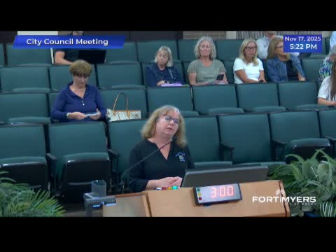
Residents and neighborhood representatives urged the council to reject the change or require a planned unit development instead, citing traffic safety, existing infrastructure strain and the risk that future owners could alter plans. Lynn Sullivan, who said she lives adjacent to the site in Ward 6, told council members she was "frightened" by the prospect of hotels and commercial intensification near existing residential communities. Bob McConaughey, representing neighborhood concerns, cited a planning-board finding of inconsistency and warned that the county would not improve roads, potentially leaving the city to pay for mitigation.
Applicant representatives and staff, including planner Nicole Devon and traffic consultant Jason Utley, told the council the requested corridor commercial future land use and CINR rezoning align with surrounding development, airport‑oriented land uses and the city comprehensive plan goals for commercial activity near the interchange. Sawyer Smith, representing the applicant, said the property owner has no intention of building residential uses and argued that a PUD is optional and costly for a landowner. Planning staff noted the planning board previously took a negative recommendation on portions of the request but staff recommended approval of the rezoning for the stated commercial objectives.
Council members debated whether the council could or should require the applicant to submit a PUD (planned unit development) before approving the land use change. City attorney Grant Alley and applicants' counsel told the council it cannot force the property owner to pursue a PUD; a PUD remains an option the applicant could choose to provide greater specificity. Councilmembers who voiced reservations urged the applicant to return with more defined plans or to pursue a PUD to reduce neighborhood uncertainty.
Votes at a glance: the motions to amend the future land use map and to adopt the CINR rezoning passed after roll-call votes and public debate. The ordinance and rezoning are subject to the quasi‑judicial process noted by staff; site‑level design and access will be determined later in permitting and site‑plan review.
The council closed the hearing after testimony and debate. The city will proceed with next steps in the comprehensive plan and rezoning process under the city's public hearing rules.