Chena Riverfront subcommittee outlines plan 'buckets' and documents changes since 2016
Loading...
Summary
Subcommittee members identified priority plan chapters — including flood control, water quality/fisheries habitat, river access and river-oriented development — and discussed observed changes since 2016 such as increased subdivision development, more on-water recreation, siltation and evolving contaminants concerns.
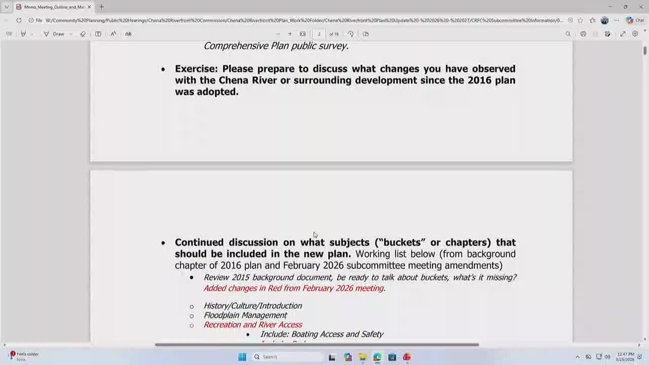
The Chena Riverfront Plan Subcommittee spent much of its March 25 meeting cataloging observed changes since the 2016 plan and outlining draft "buckets" (chapters) for the updated riverfront plan, including transportation/riverwalk, water quality and fisheries, flood-plain management, recreation and river access, land use and economic development, and implementation.
Staff member Kellen Spielman opened the exercise asking members to compare the 2016 plan to current conditions. Spielman said the borough can run GIS analyses to quantify development; he estimated "over a 100 plus homes built on the banks of the Chena River since the 2016 plan was adopted" and offered to supply exact figures. "I can come up with the exact numbers through GIS," he told the subcommittee.
Committee members highlighted several recurring observations: increased subdivision development (notably in North Pole and other reaches), more on-water recreation (kayaks, inflatable craft and paddleboards), added boat launches and parking that facilitate river use, evidence of siltation and channel narrowing in places, and new concerns such as PFAS contamination and invasive plants. Bob Hensey said the Chena Flood Control Project has closed gates multiple times (he estimated about 20 impoundment events) and that the project shapes flood dynamics and sediment movement.
Members also discussed access and amenities: wayfinding signs, the continuing Chena Riverwalk project and potential new trailheads or bridges to link neighborhoods to the river. Several members urged that the plan emphasize watershed-scale thinking, noting Fairbanks' role in contributing to fisheries downstream on the Yukon.
Implementation ideas raised included encouraging recurring community events on the river (red/green regatta, dog-and-canoe races), fostering school and watershed partnership programs for ongoing stewardship, and using forthcoming borough aerial photography to create a current baseline of bank conditions and building footprints. Staff said aerial photos will be shot early this summer and can support the background analysis for the plan.
Next steps: the subcommittee asked staff to refine the draft buckets and prepare a concise slide package and background summary to present to the full commission next month. Staff committed to providing GIS-derived counts of near-river development and impoundment/flood-control event data to substantiate claims made during the meeting.