Get Full Government Meeting Transcripts, Videos, & Alerts Forever!
Get email alerts on the Downtown Development topic
No spam. Unsubscribe anytime.
Planning commission recommends City Council adopt San Carlos downtown specific plan and related zoning and CEQA actions
Summary
After a staff presentation and public comment, the Planning and Transportation Commission unanimously recommended that the City Council approve an addendum to the 2045 General Plan EIR, amend the land use and zoning map, and introduce ordinances to adopt the San Carlos Downtown Specific Plan; commissioners and the public debated density, the SamTrans site, parking and phasing.
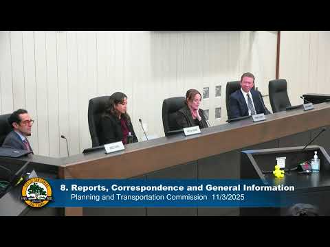
The Planning and Transportation Commission on Nov. 3 recommended that the San Carlos City Council adopt four related actions to implement a Downtown Specific Plan, including a CEQA addendum, general plan amendments, zoning map changes and the specific plan itself. The motions passed by roll call with Commissioners Anand, Kenistee, Tapias and Vice Chair Bundy voting yes; Chair Clements was excused.
Lisa Porras, the city’s planning manager, told the commission the draft downtown specific plan is the product of a three‑year process that included an 18‑member advisory committee, public workshops, an online survey that drew roughly 700 responses and an outreach record of more than 1,000 pages. “We have reached a really important milestone over the past 3 years, and we are very happy to present to you the commission the public draft downtown specific plan,” Porras said during her presentation.
The specific plan covers roughly 67 acres of the downtown core and is written as a 20‑year regulatory document to guide development, public‑realm improvements and capital projects. The downtown plan carries detailed provisions on land use and urban design, mobility and protected bicycle lanes, outdoor dining and retail display standards, plazas and public art, stormwater and rain gardens, and an implementation chapter that identifies 13 phased streetscape segments and a diversified funding strategy.
Key policy and technical highlights discussed at the hearing included:
- Land use and SamTrans site: Staff proposed one site‑specific exception — the parcel at 1250 San Carlos Avenue (the SamTrans property) — for which the plan recommends raising the minimum density to align with neighboring parcels and to allow a MUD‑120 zoning designation that could permit taller massing adjacent to Caltrain. Staff corrected a typo in its report to clarify that the agency is SamTrans (San Mateo County Transit District). The proposal envisions an eventual build‑out that could support higher densities next to transit.
- Development standards: Most zoning standards would remain the same citywide; notable changes would include raising the ground‑floor minimum height from 12 to 14 feet (maximum 16) to support retail activation and retaining a four‑story maximum on Laurel Street with a stepback at the third story (the council directed staff to keep the third‑story stepback rather than the previously proposed fourth). For the SamTrans site staff showed conceptual massing that would allow up to six stories at a 75‑foot maximum under the proposed MUD‑120 designation.
- Public realm and plaza design: The plan elevates the previously adopted Streetscape Master Plan and proposes a pedestrian‑priority downtown core (five blocks) with new plazas (including a possible 600‑block plaza on Laurel), greater outdoor dining allowances in defined tree‑strip areas, and detailed rules for furnishings (durable materials, no advertising on umbrellas, maximum 4‑foot barriers, no permanent attachments).
- Mobility and parking: The plan calls for wider sidewalks, high‑visibility crosswalks, protected bike lanes with vertical buffers, bicycle hubs and better transit first/last‑mile connections. It anticipates AB 2097’s removal of automatic parking minimums near transit and sets a suite of transportation demand management and shared‑parking strategies; consultants said their analysis found enough on‑street vacancy, even at peak periods, to allow some parking reallocation for bike lanes if paired with strong parking management.
- Sustainability and utilities: The plan requires streetscape designs to meet C3 stormwater requirements, includes rain gardens on the 700 block to detain and filter runoff, and flags coordination with Cal Water and other utility providers for subsurface upgrades. Staff emphasized that detailed design and drainage work will be resolved in engineering during implementation.
Public testimony and feasibility concerns
Several public speakers raised concerns tied to specific plan elements. Chris Hunter, counsel for the owner of 799 Laurel Street (tenant: US Bank), said the planned closure of the 700 block Laurel Street could cut off drive‑through ATM access and urged continued dialogue and mitigation: “We want to continue the conversation and explore what can be done for this property so it is not adversely affected by the closure of Laurel Street,” Hunter said.
SamTrans representatives urged flexibility on the zoning and minimum density for the SamTrans headquarters site at 1250 San Carlos Avenue. Charlotte Comis, SamTrans TOD manager, requested more flexibility and noted SamTrans’ interest in aligning redevelopment with feasibility. Economist Darren Smith of EPS told commissioners that, in the current market environment, requiring a 90 dwelling‑units‑per‑acre minimum could make redevelopment financially infeasible in the near term, slow or delay projects (because taller buildings often require higher‑cost construction types), and reduce the ability to include ground‑floor commercial space or family‑sized units. “We are concerned that the proposal to zone SamTrans headquarters property to have a minimum of 90 units per acre will present a feasibility challenge that delays its redevelopment,” Smith said.
Staff response and next steps
Staff acknowledged the SamTrans letters and said the agency and its economist would be providing formal comments; staff also noted developers may use state density‑bonus provisions if they need additional flexibility. Commissioners asked for clarifications and corrections in the plan (for example, Porras acknowledged a typographical error that showed an incorrect 75‑foot height for an MUN‑40 district and confirmed the correct code height is 50 feet). Staff reiterated that implementation sequencing and funding will be decided by the City Council and depend on available grants, community benefit funds and other sources; the plan includes an initial cost estimate for streetscape improvements (staff cited ~$125 million as an order‑of‑magnitude estimate) and a recommended phased approach (13 segments) to allow piecemeal implementation.
Votes and procedural outcome
The commission took four separate motions, one for each recommended action (EIR addendum, general plan amendments, zoning/Title 18 amendment, and introduction of the Downtown Specific Plan ordinance). Each motion was seconded and approved by the commissioners present (Anand, Kenistee, Tapias and Vice Chair Bundy); Chair Clements was excused. The item will go next to the San Carlos City Council for consideration on Nov. 24, 2025, per staff notice to the public.
What to watch
City Council deliberations on Nov. 24 will be the next formal step. Key items likely to draw further comment at council are the SamTrans site map/density discussion, mitigation for the 700‑block Laurel closure raised by the property owner and staff clarification/corrections requested by commissioners (Walnut Street setbacks, generator/parklet policy language, and additional measurable equity metrics for public‑space programming).