Get Full Government Meeting Transcripts, Videos, & Alerts Forever!
Get email alerts on the East Campbell Vision topic
No spam. Unsubscribe anytime.
ULI panel urges housing, sidewalks and bike upgrades for East Campbell Avenue in Campbell
Summary
An Urban Land Institute technical assistance panel recommended concentrating new housing at catalyst parcels and improving sidewalks, shade, bike infrastructure and wayfinding on East Campbell Avenue, while council members praised the vision and flagged concerns about a potential road diet and parking impacts.
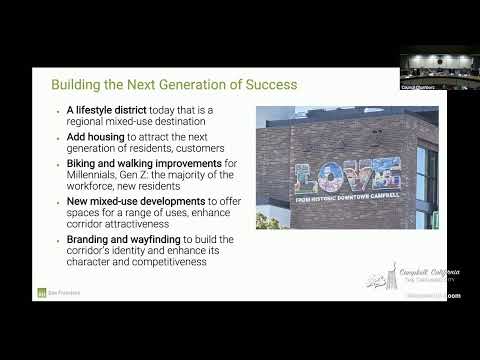
An Urban Land Institute (ULI) technical assistance panel on Sept. 16 presented a revised vision for East Campbell Avenue that urges the city to concentrate higher‑density housing at a handful of catalyst sites and to prioritize multimodal public‑realm upgrades to better link Downtown Campbell and the Pruneyard.
"Unlike the Pruneyard or Downtown, it really lacks the kind of identity, walkability, and investment that we would like to see in Campbell," Nathan Donato Weinstein, the city’s economic development manager, said as he introduced the panel. Nell Sealander, the panel chair and economic and community development director for South San Francisco, told council members the TAP interviewed nearly 30 stakeholders and identified recurring themes: housing as a primary land use, tree canopy and shade, pedestrian and bicyclist comfort, and parking and traffic concerns.
Panelists laid out a multi‑pronged approach. Katya Kermandar, a Bay Area residential developer, said state laws and streamlining tools the panel reviewed could enable taller, transit‑oriented projects and observed that, "with your new zoning in place, really what gets built here, though, is largely up to the market." She added the market often requires larger‑scale buildings to reach financial feasibility and that cities should use objective design standards to mitigate massing and step down heights near existing neighborhoods.
Patricia Santano of BAR Architects identified specific catalyst parcels the panel evaluated. She said vacating a short dead‑end street called Foot Avenue could create roughly one acre of combined footprint with a potential of "50 to 75 units" and space for a public plaza. She also described the Grayland Professional Office Park as a 1.6‑acre site that, in the right market, might accommodate roughly "75 to 120 dwelling units." The panel contrasted those possibilities with the corridor’s current high‑density mixed‑use ranges of approximately 34–45 dwelling units per acre.
On public‑realm improvements, Mariana Ricker (SWA Group) recommended three priorities: study a road diet and traffic calming strategies, expand and standardize wider sidewalks with space for large trees, and plan for separated bicycle infrastructure as part of a citywide multimodal study. "Creating additional space for bike infrastructure really would involve taking a harder look at the existing right of way and reallocating some of that space," Ricker said.
Ron Golomb (RJ Urban Advisors) focused on implementation and funding, urging a cohesive wayfinding and branding strategy, improved signage to parking structures, and use of funding tools such as developer fees, affordable‑housing‑linked infrastructure funds, transit‑oriented grants and an enhanced infrastructure finance district (EIFD) as long‑term mechanisms. He also recommended studying business improvement or property‑owner districts to support programming and marketing.
Council members generally praised the panel for its analysis and stakeholder outreach, calling the presentation "very impressive" and urging staff to be proactive in pursuing catalytic change. Several councilors singled out the Crestley and Grayland sites as short‑term opportunities and asked staff to consider stronger incentives and earlier coordination with property owners.
At the same time, several members expressed reservations about a road diet on East Campbell Avenue. One councilor warned that parts of the corridor serve as a major thoroughfare and that reducing vehicle lanes could affect residents whose only access points feed onto Campbell Avenue. The council debated tradeoffs between slowing traffic to improve pedestrian safety and preserving vehicular access for landlocked neighborhoods and nearby arterials.
There were also recurring concerns about parking. Golomb said paid parking can be an effective tool in some cities but acknowledged local opposition, noting, "Campbell is not about paid parking; it's about free parking that's important to protect," and suggested wayfinding and digital tools as alternatives to force parking policy changes.
The panel said the TAP’s full written report will arrive in about two to three months with more detailed recommendations and design guidance. Council members concluded the study session by thanking the panel and urging staff to internalize the recommendations, pursue near‑term, low‑cost improvements where feasible, and return with follow‑up analyses that address traffic, parking, funding and neighborhood impacts.
The study session adjourned with the council proposing a short break before continuing other business.