Get Full Government Meeting Transcripts, Videos, & Alerts Forever!
Get email alerts on the Middle Housing topic
No spam. Unsubscribe anytime.
Puyallup council weighs volcanic‑hazard exclusion as it drafts permanent middle‑housing rules
Summary
Planning staff told council they aim to adopt permanent middle‑housing regulations before the interim ordinance expires on June 30, 2026. Council members debated whether to keep a volcanic‑hazard (Lahar) exclusion that currently covers 31% of single‑family lots or to adopt updated USGS mapping that would reduce the exclusion to about 13%.
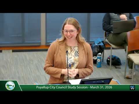
Katie Baker, the city’s planning manager, told the Puyallup City Council on March 31 that staff is drafting permanent middle‑housing code amendments to replace an interim ordinance and meet state requirements.
“The goal is adoption of these permanent regulations before the interim ordinance expires on 06/30/2026,” Baker said, describing changes to definitions, RS‑zone standards and parking rules. She summarized the state mandate enacted in 2023 (House Bill 1110) that requires tier‑2 cities like Puyallup to allow certain middle‑housing types and minimum unit densities (generally two units per lot and up to four in limited circumstances, and six of nine middle‑housing types across residential zones).
Baker told the council that the interim ordinance adopted last year included an exception that bans new middle‑housing allowances in a volcanic‑hazard (Lahar) area, and that when staff submitted the interim ordinance the state Department of Commerce flagged a potential compliance problem. “The state law allows the city to exclude up to 25% of single family lots from middle housing requirements, but our interim zoning exception covers 31% of the RS zone lots,” Baker said.
Staff presented two map options: the interim map that produced the 31% exclusion and a map using updated U.S. Geological Survey (USGS) Lahar boundary data plus a half‑mile reduction that staff said would lower the exclusion to about 13%. Baker said the updated USGS data “is more current, and it would bring us under that 25% threshold,” and asked council for direction on how to treat the volcanic‑hazard exception in the permanent code.
Deputy Mayor Johnson said he was not yet ready to back the planning commission’s recommendation and urged staff to return with alternative map options, noting a preference for a compromise that would bring the exclusion down to—rather than all the way to—13%. “I want to go on the record for stating I’m not in support of the planning commission’s recommendations yet until I have a chance to kind of go over this myself,” Johnson said. He suggested adjusting the buffer so the city lands “right at” the 25% allowance as a possible compromise.
Several council members pressed staff for additional details: how the USGS update reduced the mapped area, whether buildable‑lands and critical areas were accounted for, how accessory‑dwelling‑unit (ADU) allowances would function inside the exclusion area, and whether a reduction in mapped area could produce displacement of residents. Council member Smallco asked for demographic information and notification plans for affected residents and business owners; Baker said staff could provide additional demographic analysis and would use the updated USGS boundary as the baseline for future map options.
On parking, Baker explained the middle‑housing parking approach carried from state guidance: no off‑street parking required within a half‑mile of a major transit stop, a per‑unit parking ratio that varies by lot size, and that a separate statewide parking maximum recently passed by the Legislature would take effect in a year or two and is not yet being implemented in the city’s code changes.
Council members gave a mix of initial views: some said they favored the 13% map based on the USGS data, others favored a political compromise near the 25% allowance, and several asked staff to return with alternative options and analyses. Baker said staff would finalize an ordinance for council consideration in April and noted that, if needed, the city might seek an extension of the interim ordinance (which expires June 30) to allow more time for analysis and deliberation.
The session moved on after council members provided policy direction; no final ordinance vote was taken that night.