Get Full Government Meeting Transcripts, Videos, & Alerts Forever!
Get email alerts on the Regional Planning topic
No spam. Unsubscribe anytime.
Rutland regional planners outline Act 181‑driven map changes; residents press for source‑water and parcel remedies
Summary
At a March 17 public hearing, Rutland Regional Planning Commission staff walked through the draft 2026–2034 regional plan and future land‑use map required by Act 181; residents and town officials pressed staff on parcel‑level mapping that appears to overlap source‑water areas, asked how tier 1B opt‑in works, and sought deadlines for municipal responses.
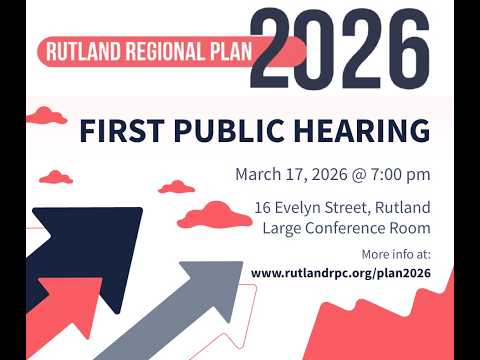
Rutland Regional Planning Commission staff presented the draft 2026–2034 regional plan and its companion future land‑use map at a required public hearing on March 17, saying the effort is intended to guide community economic development while conforming with state planning statute (Title 24, §4348A).
Stephanie Burke, the RPC project manager, summarized a three‑phase engagement that began in 2023, described how the commission incorporated Land Use Review Board (LURB) pre‑application findings, and said the draft plan prioritizes compact “centers” and identifies areas for growth and conservation. Burke told the audience the plan would cover 2026–2034 and that the RPC is demonstrating statutory conformance in an accompanying report available on the plan landing page.
Burke gave a detailed explanation of the land‑use chapter and the changes driven by Act 181 (enacted June 2024). She said the draft maps propose roughly 38 downtown or village centers and 16 planned growth/village areas; the seven higher‑density categories collectively cover about 6% of the region’s land area and roughly 2% of the region is currently mapped as tier 1B eligible. “With a tier 1B designation, Act 250 exemptions would apply to housing and mixed‑use development of 50 units or fewer on 10 acres or less,” Burke said, summarizing the limited exemption that state statute provides for certain projects in eligible areas.
Burke and other RPC staff emphasized that the map is not a local zoning ordinance and does not by itself override municipal land‑use regulations. The commission said it mapped at the parcel level and, at LURB direction, sought to create contiguous mapped blocks rather than scattering small pockets across the region. That parcel‑level approach, staff said, explains why some large parcels appear wholly mapped into an enterprise or other category even when only a portion is actively used for industry.
Public commenters repeatedly asked for exceptions and clarifications. Tom Fuller, a select board member who identified himself during the hearing, asked why a mapped enterprise area overlaps his town’s water‑source protection area; he and other residents requested that source‑water protection areas be added to the map. Burke said the RPC received such requests from the town and plans to include source protection areas in an upcoming map revision.
Several residents voiced concern that the mapping process effectively would limit private land use or trigger automatic denial in Act 250 proceedings. “My land for some reason, even my house, has been divvied out. You can look at this map,” a resident identified as Bill said, pressing that the mapping felt like a loss of control. Burke responded that the map is advisory for most regulatory purposes: owners retain the ability to use land consistent with local regulations, and Act 250 review remains a case‑by‑case process where the regional plan is one piece of evidence rather than an automatic veto.
Attendees sought clarity about tiers and the municipal opt‑in process. Burke said towns shown as tier 1B eligible must pass a municipal resolution to opt in; those municipal resolutions must be attached to the adopted regional plan submitted to the LURB. She listed towns shown as tier 1B eligible in the draft and urged any municipality seeking the partial Act 250 exemption to submit its resolution before the RPC adopts the plan.
Multiple commenters said they felt outreach had not reached all residents; RPC staff acknowledged both the scale of the engagement work and gaps in local notice and urged towns and residents to contact legislators and the LURB with rulemaking concerns. The commission also announced three supplemental community meetings (March 19 in Brandon; March 24 in Wallingford; March 26 in the location listed on the RPC site), set a final comment deadline of March 27, said it would post revisions for a draft public hearing on April 16, and scheduled final adoption for May 19 at the RPC office.
What happens next: the RPC will consider submitted public comments, revise the draft plan and map where warranted, and then adopt the plan for submission to the Land Use Review Board. Municipal resolutions opting in to tier 1B must accompany the adopted plan if towns want those areas included for LURB consideration.
The hearing delivered detailed technical explanation of categories and criteria under Act 181 and drew persistent requests from towns for clearer mapping around water supplies and for better municipal‑level notice. The RPC said it will update the online map and materials and continue supplemental in‑town sessions ahead of the April and May deadlines.