Get Full Government Meeting Transcripts, Videos, & Alerts Forever!
Get email alerts on the Land Use Development topic
No spam. Unsubscribe anytime.
Developers present 110‑acre Estates at Sciota Crossing plan; residents press on schools, ponds and fire access
Summary
Dr. Horton and Addison Development presented plans for a 110‑acre Commercial Point subdivision with 321 lots, about 27.6 acres of open space and age‑targeted patio homes. Residents questioned school enrollment impact (developer estimates ~240 students), stormwater ponds and narrow sideyards; developers said detailed technical review and TIS will follow.
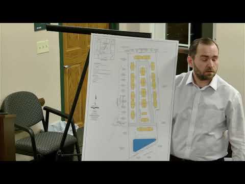
Dr. Horton representatives presented the Estates at Sciota Crossing plan to the Village of Commercial Point Land Use Committee, describing a 110‑acre subdivision annexed into the village and zoned for planned residential development.
The developers said the plan would include about 27.6 acres of open space (versus 18.1 acres required), preservation of more than seven acres of woodland, a neighborhood park with playground and pavilion, trails and a mix of product types including patio homes targeted to older buyers. “We’ve made a commitment to try to preserve as much open space as we can,” the developer said.
Why it matters: The plan proposes 321 lots with a mix of single‑family and patio homes and a gross density under the village’s PRD maximum. Using a conservative 0.75 student‑per‑home ratio derived from Taz Valley Local School District data, the developers estimated the project could generate about 240 students over the build‑out; at an anticipated pace of roughly 40 homes per year, they expect roughly 30 students each year as the subdivision phases in.
Neighbors focused most of their questions on stormwater and public‑safety features. Residents asked whether ponds would be engineered to avoid off‑site impacts, what safety measures (benched edges, riprap, fencing) would be included, and whether playground equipment would be accessible to people with disabilities. The developer replied that the ponds are intended as detention/retention features designed to contain and release stormwater under engineered criteria, that fountains and aesthetic treatments were proposed, and that all designs will be reviewed and signed off by the village’s engineers and fire officials.
Residents also raised fire‑safety concerns tied to the proposed lot spacing. The presentation showed some 63‑foot and 50‑foot lot typologies and pointed to 10‑to‑13 foot separations between building faces for the product shown; residents warned of risks of rapid attic fire spread when homes are close. Developers said technical review by fire, police and the village engineer is required before approval and noted that code and fire‑rating requirements would be incorporated where necessary.
Traffic and infrastructure: The developers confirmed a traffic impact study (TIS) will be required before approvals and will inform whether the project must pay a proportionate share of intersection or road upgrades on surrounding corridors such as Durret and McCord Roads. The team said phasing has not been finalized but that early phases would likely include two product types to broaden market appeal.
What happens next: Presenters solicited public feedback and said detailed engineering — including stormwater plans, TIS, fire access plans and possible conservation or CCR language for preserved woodlands — will be completed for technical review and for future hearings before council and planning bodies.
Attribution: Quotes and summary material come from the public presentation by the developer team (Jack and company) and public comments recorded during the Land Use Committee meeting. The meeting also recorded questions from multiple residents and fire‑safety comments from the public.