Get Full Government Meeting Transcripts, Videos, & Alerts Forever!
Get email alerts on the Evacuation Analysis topic
No spam. Unsubscribe anytime.
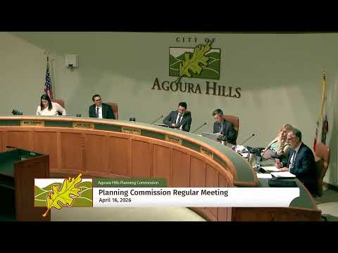
Agoura Hills planning commission backs evacuation analysis after hours of public objections
Summary
After more than two hours of public comment raising safety concerns about Kanan Road and possible high-density housing, the Agoura Hills Planning Commission voted 4-0 to recommend that City Council adopt a General Plan amendment updating the safety element to include a new evacuation analysis and the 2024 multi-jurisdictional hazard mitigation plan.
Agoura Hills — The Planning Commission voted unanimously Thursday night to recommend that the City Council adopt a General Plan amendment updating the safety element to incorporate an updated evacuation analysis, the adopted evacuation plan and the 2024 multi-jurisdictional hazard mitigation plan.
The 4-0 vote followed lengthy commissioner questioning of staff and more than two hours of public comment focused largely on the capacity of Kanan Road and other local evacuation routes. Commissioner Stein moved the recommendation; Vice Chair Sharon seconded. Commissioners Platzer, Stein, Vice Chair Sharon and Chair Roth voted in favor.
Staff told the commission the update is a planning and feasibility action intended to bring Agoura Hills into compliance with state law, specifically Government Code section 65302.15, and that the evacuation analysis is exempt from the California Environmental Quality Act under State CEQA Guidelines sections 15262, 15269, 15301 and the common-sense exemption (section 15061(b)(3)). "Staff respectfully recommends the Planning Commission adopt the resolution recommending that the City Council of the City of Agoura Hills adopt a resolution approving a general plan amendment to revise the table of contents in the safety element," a staff presenter said.
Commissioners pressed staff on assumptions used in the analysis. Staff and presenters said the study models conservative, worst-case scenarios — including full buildout consistent with the city's 2035 General Plan, 100% hotel occupancy in the modeled scenarios, and an assumption of two vehicles per household — and that some scenarios assume parents drive to schools to collect children. Staff also emphasized that operational decisions in a real emergency (lane reversals, road closures, traffic control) would be made by incident command — typically the Los Angeles County Fire Department or the Los Angeles County Sheriff’s Department — and not by the city.
Residents and neighborhood groups urged the commission to delay or reject the recommendation, arguing the report underestimates traffic volumes and that adding housing near major evacuation corridors would increase life-safety risk. "All models are wrong, some models are useful," Jay Crutcher, a Forest Cove Park-area resident, told the commission, urging the city to conduct evacuation drills so residents develop practical evacuation habits. "Drills that teach residents the efficient and effective behaviors ... so that when a very bad day happens, our entire community knows what to do," he said.
Several speakers asserted that upzoning could add hundreds of units near Kanan Road. One commenter cited a figure that appeared frequently in public testimony — 564 apartments — and warned the additional vehicles would overwhelm local arteries. Staff responded that the Planning Commission's action was to approve a study and a General Plan table-of-contents change, not to approve any development projects, and confirmed the city had received no development applications for the three Kanan-area shopping-center parcels discussed by many residents.
Technical critiques focused on specific intersections and modeled volume-to-capacity (V/C) ratios. Staff said that while a majority of roadway segments modeled have a V/C ratio at or below 1.0 under the scenarios considered, six segments exceed a 1.0 V/C ratio in at least one scenario — two segments on Reyes Adobe and multiple southbound segments on Kanan Road — indicating those segments would be the most impacted in a large-scale evacuation.
Commissioners acknowledged the limits of modeling and the strength of residents' accounts of past evacuations but said the study establishes a data baseline to guide mitigation, future updates and preparedness efforts. Commissioner Platzer and others said they supported forwarding the recommendation reluctantly but with an expectation of periodic reevaluation; several commissioners urged staff and the city to pursue drills, improved communications and grant funding to support preparedness and operational improvements.
The Planning Commission's recommendation now goes to the City Council for final action at a future public meeting. Staff said the evacuation analysis and related safety-element amendments may be revisited and updated as housing or other conditions change.