Get Full Government Meeting Transcripts, Videos, & Alerts Forever!
Get email alerts on the Swanoa Small Area Plan topic
No spam. Unsubscribe anytime.
Buncombe County reviews Swanoa small‑area plan: flood mapping, wildfire risk, buffers, housing and a $20M sidewalk estimate
Summary
County planners briefed commissioners on the draft Swanoa small‑area plan, focusing on hazards and resilience (flood maps, a proposed 10‑year look‑back for the substantial‑improvement rule, wildfire risk and private‑property limits), riparian buffers constrained by state law, housing affordability actions, transportation priorities (US‑70 sidewalks, greenway work, RiverLink easements and buyouts) and a phased implementation timetable.
Buncombe County planning staff led the Board of Commissioners through a detailed review of the Swanoa small‑area plan, describing more than 100 policies and actions intended to guide recovery and future growth after recent storm impacts.
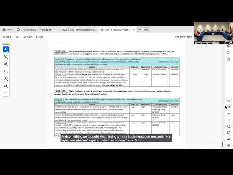
Hazards and resilience dominated the session. Staff said many policies will apply countywide while helping Swanoa specifically, and highlighted three priorities: updated flood mapping, stronger development standards in special flood hazard areas, and increased awareness for hazard vulnerability. Commissioners were told that North Carolina develops flood maps that FEMA accepts and that new maps are in progress; staff offered to have mapping lead Nate follow up with an estimated timetable. A commissioner noted that, "according to Nate, the flood maps won't be updated for two and a half to three years," and staff said the plan's actions would apply to existing maps until any new maps are adopted.
Planners proposed changing the substantial‑improvement/threshold look‑back from one year to a longer look‑back (staff discussed five to ten years, the draft contains a proposed 10‑year look‑back) so incremental work cannot be used to avoid meeting modern flood standards. Staff and commissioners framed this as an attempt to prevent property owners from 'gaming' the system by spreading renovations over several years to avoid triggering upgrades.
Wildfire risk was another recurring theme. Commissioners urged that wildfire prevention be prioritized higher in the plan and asked staff to coordinate with emergency services on incentives and potential programs to help private property owners remove hazardous fuel. Staff said county authority over private lands is limited and the plan leans on education and coordination with emergency services, though they will check whether incentive programs or policies could be added.
Riparian buffers and stream restoration actions are in the draft; staff said state law places limits on where the county can require buffers, so the plan uses an "evaluate and incentivize" approach and will identify where stricter local requirements are legally feasible.
The housing chapter emphasizes preserving existing affordable housing, expanding pathways to home ownership and using zoning tools for missing‑middle housing, but commissioners questioned why many actions were rated as "low impact" given the scale of housing need; staff said federal funding constraints limit what the county can require and that implementation will rely on strategic‑plan and budget priorities.
Transportation discussion centered on safety along US‑70. Staff said sidewalks on US‑70 are the highest local priority for the Swanoa area; one commissioner estimated sidewalk costs on the corridor at about $20 million. RiverLink received funding (via the North Carolina Flood Blueprint) to place a conservation easement on the Woodmen of the World site and to undertake flood‑benching to restore a portion of the floodplain; the county expects to close on initial buyout properties in May.
On economic recovery, staff proposed a program of pre‑approved building/site plans (examples discussed from other cities) to expedite reconstruction and reduce permit costs for residents who rebuild after disasters. That proposal included exploring partnerships with nonprofits to supply free or low‑cost pre‑approved plans.
Staff told commissioners the draft plan will be refined with steering‑committee feedback, then released for public comment in May; a draft will be returned for review in August, with a possible adoption vote in September if the schedule holds. Commissioners pressed for clearer implementation timelines and closer ties between plan priorities and the strategic‑planning and capital‑budget processes so the plan's recommendations can be prioritized and funded.
No final adoption votes were taken; commissioners provided feedback and asked staff for follow‑up (flood‑map timetable, wildfire incentives, possible inclusion of stronger language about increasing storm events).