Get Full Government Meeting Transcripts, Videos, & Alerts Forever!
Presenter explains how to use Volusia County Disaster Risk Reduction Area map
Summary
A Volusia County tutorial video guides residents through the interactive Disaster Risk Reduction Area (DRRA) map, showing how to check whether properties fall within DRRA or flood-hazard zones and explaining that inclusion may lead to consideration for voluntary buyouts; contact information is provided.
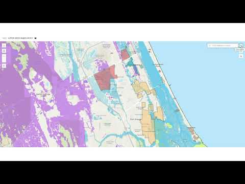
Volusia County released an online tutorial explaining how residents can use the county’s interactive Disaster Risk Reduction Area (DRRA) map to identify properties that local municipalities have flagged for elevated flood or storm risk.
The presenter said, "This interactive map shows areas identified by local municipalities as disaster risk reduction areas," and demonstrated tools on the right-hand panel — including a…
Already have an account? Log in
Subscribe to keep reading
Unlock the rest of this article — and every article on Citizen Portal.
- Unlimited articles
- AI-powered breakdowns of topics, speakers, decisions, and budgets
- Instant alerts when your location has a new meeting
- Follow topics and more locations
- 1,000 AI Insights / month, plus AI Chat