Get Full Government Meeting Transcripts, Videos, & Alerts Forever!
Get email alerts on the Zoning Map Amendment topic
No spam. Unsubscribe anytime.
Lake County adopts zoning map amendment PL25-101 for three Highland Springs Road parcels
Summary
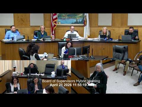
The Lake County Board of Supervisors adopted on second reading ordinance PL25-101 to reclassify three Highland Springs Road parcels to an industrial designation after public comment raised concerns about agricultural preservation and documentation of a 2008 land-use decision.
The Lake County Board of Supervisors adopted on second reading ordinance PL25-101 to amend the county zoning map and bring three parcels on Highland Springs Road in Lakeport into conformance with an industrial land-use designation and the airport land-use compatibility plan.
Community Development Director Maria Turner told the board that following a ‘‘robust public hearing’’ at the previous meeting, supervisors in attendance had voted to support the rezoning and that staff was available to answer questions. The ordinance covers parcels at 4325, 4375 and 4425 Highland Springs Road, listed in the discussion by partial APN references provided during the hearing.
During public comment, resident Marggo Kara urged the board to continue the item to allow more due diligence and to preserve agricultural land. Kara said the rezoning could remove the agricultural potential of roughly 50 acres and contended that the county’s documentation of a 2008 rezoning did not identify the subject parcels by address or APN. "Due diligence calls for confirming documentation before a drastic and almost irreversible action is authorized," Kara said.
County staff responded that a Public Records Act request had prompted follow-up with the speaker and that staff had brought forward both the county's official land-use designation map and the map included in the 2008 general plan; staff said those maps show the parcels with an industrial land-use designation and that the official land-use designation map is the overriding authority.
Supervisor Hood described his understanding of the 2008 process, saying the parcels were retained in agriculture to restrict rezoning unless needed for airport expansion or related services, and he disputed that the earlier designation was a mistake. Staff also noted that the landowner had previously testified that inconsistent zoning had prevented projects from moving forward for about 20 years.
County counsel called for the ordinance to be offered for adoption. A board member moved to offer the ordinance; the board recorded affirmative votes and the chair announced the ordinance passed on second reading. The transcript records board members voting in favor; the document does not contain a clear, unambiguous roll-call tally in machine-readable form.
The board took no additional directions on follow-up tasks during the hearing. The ordinance will take effect in accordance with county rules for adopted ordinances unless an effective date or further administrative steps are announced in subsequent proceedings.