Get Full Government Meeting Transcripts, Videos, & Alerts Forever!
Get email alerts on the I375 Framework topic
No spam. Unsubscribe anytime.
Detroit kicks off I-375 neighborhood framework; officials say project is "fully funded" and seek input on 30 acres of new land
Summary
City planning staff hosted a public kickoff for the I-375 Neighborhood Framework to shape zoning and land use for about 30 acres created by replacing the depressed I-375 freeway with a surface boulevard; officials said federal and state funds are obligated and outlined a 2026–2028 construction window.
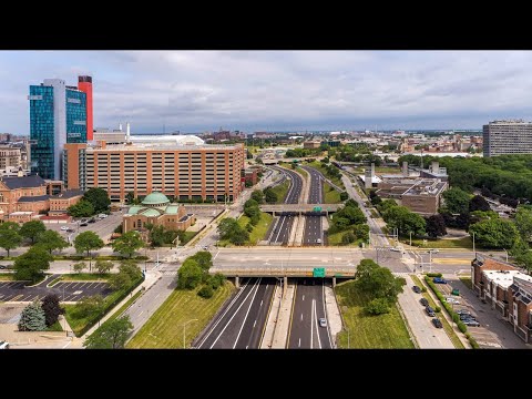
City of Detroit planning officials on Tuesday evening launched the public kickoff for the I-375 Neighborhood Framework, describing a community-driven process to decide how roughly 30 acres of land freed by converting the depressed I-375 freeway to a surface boulevard should be used.
John Civil of the City of Detroit’s Planning and Development Department and Ebony Payne, the project manager for the zoning and land-use framework, told attendees the effort will focus on zoning, urban design, mobility and policies to ensure the new land supports culture, housing, open space and economic opportunity. City staff said the framework runs through August 2025 and will feed recommendations into the boulevard’s design.
Why it matters: replacing the sunken interstate with a surface boulevard is expected to make about 30 acres available adjacent to downtown neighborhoods. Officials said decisions about naming, historic recognition and land disposition will be shaped by resident input through engagement stations, worksheets and follow-up outreach available at detroitmi.gov/i375.
At the meeting’s question-and-answer session, a staff member identified by role as the Director of the Planning and Development Department said the project is “fully funded.” “That’s an easy answer for me — yes, we have the money in the bank,” the director said, adding that federal grant funds are obligated and state funds cover the remainder of the project.
Officials also addressed a range of community concerns raised by attendees. On historic recognition, staff said honoring the histories of Black Bottom and Paradise Valley is a priority for the City and MDOT, though the current work centers on determining what the real estate will become and where markers or larger commemorative treatments would be located. The city said there has not yet been formal contact with the Michigan historical marker program but that several existing markers in the area inform the conversation.
Construction and mitigation: staff described a progressive design-build procurement that brings contractors into the design phase early to reduce construction impacts and preserve access and mobility. They said some early work is expected late in 2025 and that major construction would occur in 2026–2028. The team highlighted plans for a construction mitigation plan, business-support coordination with Downtown Detroit Partnership, and extensive communications with transit riders and the public.
On ownership and disposition, city staff said the underlying ownership of the highway property currently rests with MDOT and the State of Michigan; whether parcels are transferred to the city or released over time for redevelopment will be determined through the framework and subsequent actions. For flood risk, staff described significant stormwater improvements and added outfalls to reduce combined-sewer impacts and ease localized flooding as part of the project.
Next steps: staff encouraged continued participation at engagement stations, by submitting question cards and via the project website. They said the framework’s discovery and analysis phase will continue through August 2025, with a public process to shape zoning and implementation recommendations that can be integrated into the boulevard design.