Get Full Government Meeting Transcripts, Videos, & Alerts Forever!
Get email alerts on the Transportation Safety topic
No spam. Unsubscribe anytime.
Transportation Commission launches Rogers Street corridor study, flags safety hotspots and workshop outreach
Summary
The Transportation Commission began a corridor study of Rogers Street, Madison Street and Kinser Pike to reduce serious crashes under the city's Vision Zero 2039 plan. Staff and consultant Tool Design Group presented data showing 80 serious-injury crashes in a 10-year window, outlined two design tracks (short-term quick-build and 10-year visions) and announced public outreach during the week of March 23.
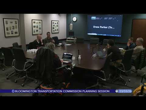
The Transportation Commission on Wednesday opened a steering-committee meeting to begin a corridor analysis of Rogers Street, Madison Street and Kinser Pike, staff said, and set public outreach for the week of March 23.
The study is anchored to the city's Vision Zero 2039 goal to eliminate fatal and serious roadway crashes. Hank, a city staff member who led the introduction, said the commission will serve as the study's steering committee while Tool Design Group serves as the project consultant. "We are here to talk about the Rogers Street, Madison Street, and Kinser Pike corridors," Hank told the commission, stressing that the analysis will pair street design with land-use review and community engagement.
The consultant, Drew Parker, said the technical work combines crash data, demographic vulnerability, and public comment to prioritize corridors. "The purpose of the project is to evaluate existing conditions and then make recommendations for design changes to improve safety along this corridor," Drew said. He reported that in a 10-year police-report-based review there were 80 crashes that resulted in serious injuries within the study extents; there were no fatalities in that dataset. Pedestrian-involved crashes, Drew added, were more likely to result in serious injury.
Why it matters: staff and the consultant framed the study as both safety-first and multi-modal, pairing a 10-year vision with short-term, quick-build improvements aimed at near-term safety gains. The corridor carries a mix of land uses and ongoing redevelopment (Aspen Heights, the Trades District and the Hopewell project), making design choices consequential for access, transit and new development.
Key findings presented
- Crash history: 80 serious-injury crashes over the chosen study window; 11 serious pedestrian injuries noted in the data. - Speed: two traffic counts showed 85th-percentile speeds of about 33 mph and 38 mph at different corridor locations in posted 25—25/30 mph sections, a factor the team said likely contributes to crash severity. - Infrastructure gaps: sidewalks are mostly present but have gaps north of 17th Street; bicycle facilities are fragmented northward and a continuous low-stress bike connection across the railroad tracks is missing. - Lighting and crossings: staff mapped both standard overhead and pedestrian-oriented lights and identified intersections with limited or unreliable illumination; commissioners asked for more detail on placement and functioning of fixtures. - Parking and land use: on-street parking is permitted in only a few pockets and utilization is very low; land use along the corridor varies from single-family housing to mixed-use downtown and institutional sites.
Jurisdictional limits and high-priority spots
Commissioners and staff flagged two jurisdictional constraints. The intersection at the State Road 4546 bypass (referred to in the meeting as "the bypass") emerged as the corridor's highest frequency location for serious-injury crashes; staff said that intersection is INDOT jurisdiction. "We are limited on what we can do," Hank said, explaining that the city has had engineering-level conversations with INDOT but major changes likely require state action and funding.
Separately, the Madison Street bridge over CSX tracks was discussed; a commissioner noted that Monroe County owns bridges over 20 feet and would need to be involved in any structural or major configuration changes to pedestrian access on that structure.
Public engagement and next steps
Staff announced a concentrated public outreach effort during the week of March 23, including pop-up events along the corridor and a formal public meeting at Switchyard Park on Wednesday at 5:30 p.m. The project will produce two alternative design concepts, then plan-view concepts at up to 10 representative intersections. Staff said the final study will be submitted to the Transportation Commission for review around midsummer.
What the commission requested
Commissioners asked staff to: add school locations to maps to better assess safe routes to school (several schools were named during discussion), provide additional lighting detail and reliability information, coordinate bus-stop and transit data with Bloomington Transit staff, and continue coordination with INDOT and Monroe County on the bypass and bridge constraints.
The meeting concluded after brief procedural motions. The commission will continue to review alternatives and public feedback as staff develops concept designs and implementation options.