Get Full Government Meeting Transcripts, Videos, & Alerts Forever!
Get email alerts on the Intelligent Traffic Network topic
No spam. Unsubscribe anytime.
Columbia County manager details ‘intelligent traffic network,’ cites time, fuel and crash reductions
Summary
County Manager Scott Johnson explains how adaptive InSync signals, cameras, the county-owned C3BU fiber and a Glance Travel Safely app work together to reduce congestion, save drivers an estimated $2.9 million a year and cut crashes on studied corridors.
Scott Johnson, Columbia County manager, laid out how the county’s intelligent traffic network uses adaptive signals, cameras, a county-owned fiber backbone and a smartphone app to reduce travel time, save fuel and improve safety.
Johnson said the system — built around Rhythm Engineering’s InSync adaptive-control software and tied together on the county’s C3BU fiber backbone — now covers all of Columbia County’s 83 signalized intersections. “We were the first jurisdiction in the entire state of Georgia to connect all of our traffic signals,” he said, describing cameras that count vehicles and AI software that extends or shortens greens and coordinates adjacent lights to form “green tunnels.”
Why it matters: Johnson said the network is a faster, less costly complement to widening roads, which can take many years. He told listeners the initial rollout cost a little over $2 million (about $35,000 per intersection at the time) and was funded with sales-tax sources rather than property-tax dollars. Ongoing maintenance and expansion are paid from insurance-premium tax funds and sales-tax accounts, he said.
How it works: Johnson described high-definition cameras at intersections that measure lane-by-lane demand and gaps, feed that data into real-time software and coordinate signals across corridors (a technique the presentation called “platooning”). He said the system adapts instantly to incidents, school release times and rush-hour surges to reduce stops and idling.
Emergency response and pedestrian safety: The county is piloting preemption devices on fire trucks so responding units get continuous greens; Johnson noted the trade-off that a preempting emergency vehicle can temporarily disrupt a platoon and requires the system to resynchronize. He also said the county has installed 34 rapid-flashing beacons at high-visibility crosswalks and integrated school-zone signs with the network.
App and public use: Columbia County offers a local version of the Glance Travel Safely app that provides spoken alerts tied to signals and beacons (it does not grant users priority green lights). Johnson encouraged residents to try the free app for spoken warnings about upcoming signals, active school zones or pedestrians.
Reported results: Citing independent studies attributed to Rhythm Engineering, Johnson said Columbia County drivers save an estimated $2.9 million annually in time and fuel; the studies show up to a 29% reduction in travel time on key corridors, 71 fewer stops and a 15% gasoline savings. He also cited a 26–31% reduction in crashes in studied areas on Washington Road.
Local application and projects: Johnson described a recent zoning access request near Washington Road and the Camelot subdivision that was withdrawn after the county offered traffic-network-based alternatives, including signal coordination at nearby short-distance intersections pending agreement with the state Department of Transportation. He also listed several active projects — Fury’s Ferry Road, Horizon South Parkway and Hardy McMus Road — and said a Lewisville Road–Columbia Road roundabout is scheduled to begin construction in September; a Baker Place Road–Rightsboro Road concept is due in July.
Funding and operations: Johnson said the county owns and operates the C3BU fiber network (he said a federal grant of a little over $13 million helped build the backbone) and reported very high uptime. He reiterated that the network’s initial and ongoing costs have been supported with sales-tax sources and the insurance-premium tax fund rather than the general fund or property taxes.
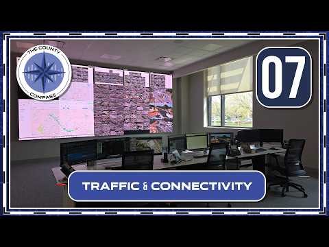
What’s next: Johnson invited residents to visit the traffic operations center in Building A, try the Glance Travel Safely app and watch for upcoming project milestones. He framed the network as a tool to squeeze more capacity from existing roads while improving emergency response and pedestrian safety.