Get Full Government Meeting Transcripts, Videos, & Alerts Forever!
Get email alerts on the Parking Study topic
No spam. Unsubscribe anytime.
City planning staff release parking study showing First/Grand View district largely under capacity; downtown block most constrained
Summary
A multi-season parking count found more than 1,400 parking spaces in the First and Grand View districts, an average district occupancy near 33%, and recurring capacity pressure on the Grand View Avenue bank block (sub-area A); staff recommended wayfinding, turnover studies and using the data to guide street improvements.
City planning staff presented results of a multi-season parking-count study at the March 11 Grandview Heights BZA meeting, reporting more than 1,400 total parking spaces across the First and Grand View districts and an average occupancy across counts of about 32.8%.
The study covered 100 street segments and three parking lots, recording four daily counts across a week in each of four seasons (112 counts and over 10,000 data points). Staff measured on-street segments (estimating spaces by measured curb length divided by 20 feet where striping was not present), and counted striped spaces in parking lots. The team ran counts at roughly 9 a.m., noon, 4 p.m. and 7 p.m. to sample morning, midday and evening conditions and excluded major holidays and local events.
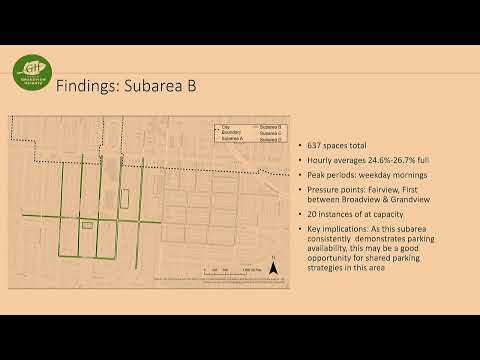
Results highlighted sub-area differences: sub area A (Grand View Avenue and the bank block) showed the tightest conditions with average hourly occupancies from about 52.7% to 77.1% and 21 instances across counts where segments reached an 85% capacity threshold used in regional planning practice. Sub area B and sub area D tended to have substantially lower averages (mid-20% to low-30% range) and many available spaces, while permit zone A (sub area C) showed that permit restrictions were working to preserve supply for residents.
Based on these findings staff recommended a coordinated wayfinding signage program to direct visitors to underused blocks and lots, conducting a turnover study to capture how long spaces are occupied, and using the dataset as an internal tool to assess the parking impact of future rights-of-way or development projects. Board members asked about sub-area boundaries, whether counts indicate commuter or resident parking, and whether peak times for special events might shift demand; staff said the raw data are stored in GIS tables and could support further analysis on those questions.
The report and its appendices are available in the BZA packet; staff said they will publish the data via the city’s planning portals and can provide the appendices on request.