Get Full Government Meeting Transcripts, Videos, & Alerts Forever!
Get email alerts on the Transportation Technology topic
No spam. Unsubscribe anytime.
NVTA staff unveils working interactive map and seeks regional coordination on technology procurement
Summary
Northern Virginia Transportation Authority staff demonstrated a working inventory map of 26 NVTA-funded transportation-technology projects and solicited committee input on data fields, public-facing design and procurement coordination; members urged separate public and procurement-facing resources and noted timing, funding and specification barriers to joint purchases.
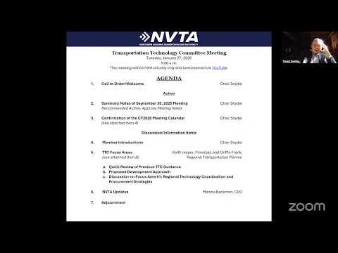
Northern Virginia Transportation Authority staff presented a working interactive map and a stepped action plan at a Transportation Technology Committee meeting, and members focused on how the tool and shared procurement information could help jurisdictions coordinate deployments.
The map currently displays 26 NVTA-funded technology projects and is intended as a living inventory that staff will populate and expand with jurisdiction-provided data, Griffin (NVTA staff) said. The tool captures project title, sponsor, funding amount, implementation year, project status, technology type and vendor/contracting information; staff will circulate an Excel template for jurisdictions to add projects and suggested a one- to two-sentence description for each project to aid clarity.
"What you're seeing on the map right now is NVTA's funded projects, both 70% and 30%," Griffin said during a screen demonstration, adding that the platform is a baseline that will improve as more jurisdictions contribute data.
Why it matters: committee members said the inventory could reveal gaps, overlaps and corridor-level patterns that are useful for regional planning and help identify opportunities to coordinate procurements or share contracts. But they also warned the group not to conflate a public-facing map with a procurement resource that could contain sensitive vendor or contract details.
"We might want to think about what information we're sharing about the project," said Hillary, deputy director for transportation for the City of Alexandria, urging a short, plain-language description in the map pop-up and filters by technology type such as parking, signals or transit. "If it's going to be public, make it a little more user-friendly." (Hillary also described her city’s curb inventory project and said the city is digitizing curb regulations to a common curb data specification so pay-by-phone vendors, enforcement tools and future autonomous vehicles can interpret curb rules consistently.)
Operational constraints: committee members and transit operators described procurement and funding challenges that limit how quickly jurisdictions can align purchases. Bob Schneider, executive director of OmniRide, said staggered equipment life cycles, differing agency specifications and federal funding rules often prevent simultaneous regional procurement.
"You may have Alexandria going first, and three years later another agency's equipment is due for replacement," Schneider said. "That means you don't get coordinated buying power—those cycles and budgets make regional buys difficult unless there's outside funding or a multi-year program to reset them." Several members pointed to state cooperative contracts and DRPT procurements as existing mechanisms that can help jurisdictions buy consistent technology without duplicative procurement work.
Procurement vs. public view: members suggested separating two outputs from the committee’s work: (1) a public-facing interactive map that highlights where technology projects are and what they do in one or two sentences, and (2) an internal procurement/reference resource with vendor assessments, contract mechanisms, and notes about cooperative or statewide contracts available to jurisdictions.
Staff next steps: NVTA staff said they will circulate an Excel template within two weeks to collect standardized project fields (including a short description and geographic location), follow up one-on-one with jurisdictional staff to fill gaps, and return to the committee in about three months with a summary of discovery-phase findings. Monica Bachmann, NVTA CEO, said NVTA staff will seek authority approval for the mapping contract at its February meeting and will later communicate the process for submitting projects into NVTA’s planning/"transaction" pipeline.
No votes or formal motions were taken. The committee adjourned after scheduling follow-up work and sharing calendar notices for upcoming regional events.
Sources: Committee discussion and staff presentation during the Northern Virginia Transportation Authority Transportation Technology Committee meeting; comments and examples from jurisdictional representatives including Alexandria, Arlington County, OmniRide and NVTC.