Get Full Government Meeting Transcripts, Videos, & Alerts Forever!
Get email alerts on the Active Transportation topic
No spam. Unsubscribe anytime.
Shorewood kicks off public feedback and interactive map for proposed neighborhood greenway network
Summary
Shorewood staff announced an evaluation of candidate streets identified in the Village's 2025 pedestrian and bicycle plan and launched an interactive web map for residents to mark where they feel safe or unsafe. The outreach runs through spring and summer and will inform staff recommendations based on speed, crash and traffic-count data.
Shorewood on an unspecified date this year launched a public engagement phase for a proposed neighborhood greenway network, inviting residents to review candidate corridors and submit geolocated feedback via an interactive web map. A Staff member said the Village adopted a pedestrian and bicycle plan in 2025 that identified streets for future greenways and that the current phase will evaluate those candidates.
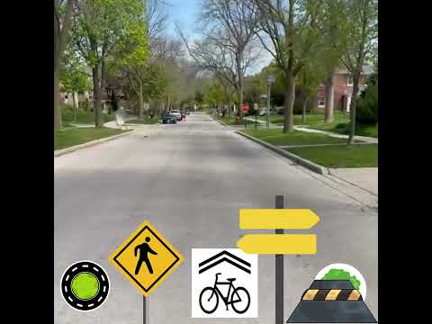
"A neighborhood Greenway is a super special street that is designed to feel extra safe, comfortable, and welcoming," the Staff member said, listing features under consideration such as traffic circles, shared-street signs, wayfinding and speed humps. The presentation emphasized changes intended to make streets safer and more accessible to people of all ages and abilities.
Staff described the evaluation approach as data-driven: it will use speed data, crash history and traffic counts to develop a set of recommendations about where and how to implement neighborhood greenway treatments. The Staff member said outreach will take place "throughout this spring and summer," and that residents will have multiple chances to "give feedback, learn more about what neighborhood greenways are, and even test a few things out yourself."
As part of the launch, staff activated an interactive web map and asked residents to "drop a pin on where you currently feel safe or unsafe on these streets." The Staff member said the project team will use the feedback gathered from the map and other outreach to refine recommendations for the greenway network.
The transcript does not specify exact dates for meetings, funding sources or which specific corridors will be advanced; staff indicated those details will be developed after analysis of the data and community input. The next procedural step described in the announcement is the conclusion of spring-and-summer outreach and subsequent development of staff recommendations based on that input and the traffic and safety data.