Get Full Government Meeting Transcripts, Videos, & Alerts Forever!
Get email alerts on the Critical Areas Update topic
No spam. Unsubscribe anytime.
Sedro-Woolley planners review critical-areas overhaul as buffer, tree-height rules loom
Summary
City staff and consultants presented a gap analysis of Sedro-Woolley's Critical Areas Ordinance and three options for wetland and riparian buffers; commissioners raised concerns about large buffer increases, costs for property owners and the effects on housing and redevelopment. Staff will return with draft code amendments.
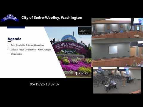
Sedro-Woolley planners heard a consultant'prepared gap analysis on May 19 that lays out three approaches to updating the city's Critical Areas Ordinance to reflect recent state law and Best Available Science (BAS).
Tom Glover, the city's planning director, introduced the presentation and said the update follows the city's recently adopted comprehensive plan and is intended "to obtain no net loss" of ecological functions in wetlands, riparian areas, aquifer recharge areas and other critical areas. Consultants Donna Keeler and Alex (on the phone) walked the commission through the technical memorandum and a set of recommended code changes.
The consultants said the update would align local definitions and procedures with state guidance, require use of best-available science when designating critical areas, and strengthen standards for wetland buffers, mitigation sequencing, riparian management, aquifer-protection measures and geologic hazard assessments. Alex explained a key technical option under consideration: using the Washington Department of Fish and Wildlife site-potential-tree-height (SPTH) methodology to set riparian buffer widths, or alternatively using fixed water-type buffers.
Commissioners repeatedly pressed staff on practical consequences. Several commissioners warned that Ecology-style increases in buffer widths (examples discussed in the presentation ranged from existing 50-foot buffers up to proposals as large as 225 or 300 feet for higher habitat-score sites) could eliminate buildable area on many small city parcels and reduce property values. One commissioner said the changes could have a "massive impact" on density and housing options in parts of the city.
Staff and consultants acknowledged the trade-offs. Nicole, a city planner, reviewed the city's existing administrative approach: a critical-areas checklist and site visit for small projects, and SEPA environmental review for larger proposals (a full SEPA review typically takes about a month). Keeler and Alex emphasized that Option 1 in the memo ties buffer widths to site-specific habitat scores and impact-minimization measures and is the approach staff prefers because it relies on site-level data rather than a single prescriptive standard.
The meeting included extensive discussion of costs and permitting burdens. Commissioners and participants cited typical professional delineation costs (one participant reported paying about $6,000 for a wetland delineation on a single-family project) and noted that mitigation planting and multi-year monitoring can be expensive. Staff said the code can retain in-lieu fee or mitigation-banking options for compensatory mitigation but that a city-run in-lieu fee program would require a specific plan and approvals from Ecology and possibly the U.S. Army Corps of Engineers.
Presenters also highlighted implications for existing structures. Properties that were conforming under current code would generally become legal nonconforming if buffers increase; repairs and maintenance would be allowed but substantial expansions could require conditional review and may not be supported. Commissioners asked whether a structure destroyed by fire could be rebuilt; staff said rebuilding rules are constrained by nonconforming-structure provisions.
Flood risk and updated mapping factored into the discussion. Staff noted that the city still relies on 1989 FEMA flood maps for base flood elevations and described a regional proposal (SC Squared in collaboration with the Swinomish Tribe and others) to update flood modeling across Skagit County. Presenters said updated flood modeling could change local floodplain boundaries and influence future code requirements.
Staff concluded that, among the three buffer approaches presented, they are most supportive of Option 1 (score-based buffers with impact minimization and site-specific data) with refinements to reduce disproportionate impacts on small property owners and to retain practical mitigation alternatives. Commissioners asked staff to return with specific code amendment options and clearer maps showing where proposed changes would matter most for Sedro-Woolley.
The commission agreed to continue the discussion at a future meeting; staff said they will prepare draft code language and outreach materials and recommended returning with clarified options for the next planning-commission agenda.