Get Full Government Meeting Transcripts, Videos, & Alerts Forever!
Get email alerts on the Land Use Zoning topic
No spam. Unsubscribe anytime.
Mills River advisory board hears rezoning plan that would reclassify most voluntary agricultural parcels
Summary
Town planning staff outlined the Imagine Mills River Unified Development Ordinance and a proposed rezoning that would place most Voluntary Agricultural District (VAD) parcels into a new "rural preservation" district; the advisory board has 45 days from the Jan. 6 notice to submit a recommendation, with adoption needed by July 1 to retain a town exemption from down‑zoning limits.
MILLS RIVER, N.C. — Town planning staff on Jan. 6 presented the Imagine Mills River Unified Development Ordinance (UDO) and a draft townwide rezoning that would reassign most Voluntary Agricultural District (VAD) parcels inside town limits to a newly named "rural preservation" zoning district.
"Please consider this letter as formal notice of the townwide rezoning that will impact farmland and VAD program in Mills River and a formal request for feedback from the local advisory boards," Michael Malichek, the town planning director, read into the record, citing a Jan. 6 notice and a new state law that requires local notice and a 45‑day review window for rezoning farmland in VADs.
The change follows session law 25‑12 (House Bill 126), which Malichek summarized as establishing the requirement that local governments notify agricultural advisory boards when they propose to rezone farmland in a voluntary agricultural district. Malichek said the UDO project began under contract with consultants Codright Planners in July 2024, and that a revised draft of code text and maps will be released to the public in mid‑March.
Why it matters: The draft map would replace a large, permissive mixed‑use zoning category that now covers about three‑quarters of the town with clearer, lower‑intensity districts intended to protect rural character. Most VAD parcels shown in Henderson County GIS that lie within town limits are proposed to become the rural preservation district, which Malichek described as the lowest‑intensity category intended to limit future subdivision and large‑scale development.
Staff emphasized that bona fide farms with qualifying documentation would retain exemptions carried forward in the UDO. "If you meet that qualification, basically, you would get an exemption from us to do what you want," Malichek said, referring to documentation such as Present Use Value (PUV) tax status, federal Schedule F tax filings, or FSA map numbers. He said smaller parcels that do not meet those qualifiers would be subject to the new zoning rules, although agricultural uses would remain permitted in the proposed districts.
The proposal also created a new "rural mix" district to accommodate properties where a single site contains both a principal residence and a business, after public feedback asked for a way to preserve longstanding home‑and‑business combinations.
Overlay districts: Staff reviewed overlay protections that would carry forward, including watershed protections (noting the town's proximity to the City of Hendersonville and City of Asheville drinking‑water intakes on the Mills River) and a floodplain overlay that limits the use of fill for development and applies FEMA standards to hazardous storage tanks while allowing ordinary agricultural maintenance.
Parcels and exceptions: Malichek said most VAD parcels inside the town limits are proposed for the rural preservation district but identified three parcels owned by the Hayes Family Trust off Mount Gilead Church Road that were treated differently because of adjacent smaller‑lot residential development. Staff estimated about 36 VAD parcels intersect town limits, and described proposed density standards: the rural preservation district would approximate one dwelling per three acres while a rural residential district would be about 1.5 acres per dwelling; staff also referenced the town's current minimum lot size standard of roughly 30,000 square feet (about 0.69 acres) as context for prior rules.
Deadlines and next steps: The Jan. 6 notice starts a 45‑day advisory review window for formal recommendations; board members confirmed that window would generally close around Feb. 20 if Jan. 6 is the effective start. Malichek warned that the town must adopt the updated UDO by July 1 to retain an exemption from the state down‑zoning prohibition; council has signaled it will allow two to three correction windows after adoption in case property owners request map adjustments at no fee.
Public record and participation: Staff encouraged any property owners who believe their parcel was misclassified to submit comments via the project website and to bring supporting documentation (PUV evidence, Schedule F, or FSA map numbers). Kristen Renul, the town tax collector and staff liaison to the agricultural advisory board, reminded attendees that the meeting was livestreamed and asked speakers to use the podium so comments would be on the record.
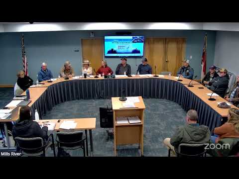
Board action: The advisory board entered the public hearing, heard the presentation and Q&A, and then voted to close the public hearing and return to regular session to prepare a recommendation. Board members discussed meeting dates to finalize a recommendation before the close of the 45‑day period (the board's regular meeting on Feb. 20 was cited; some members proposed Feb. 18 as an alternate date).
The advisory board will submit its recommendation within the 45‑day statutory window; the town planning staff will incorporate feedback into revised drafts and present materials for public review ahead of council consideration.
Sources: Presentation and Jan. 6 notice read into the record by Michael Malichek, planning director; procedural comments from Kristen Renul, tax collector and staff liaison; public Q&A during the advisory board meeting.