Get Full Government Meeting Transcripts, Videos, & Alerts Forever!
Get email alerts on the Habitat Restoration topic
No spam. Unsubscribe anytime.
Duxbury launches six-month study of Upper Bluefish River focusing on invasive reeds, tidal flow and water quality
Summary
Consultants and the Duxbury Coastal Resiliency Task Force opened a stakeholder study of the Upper Bluefish River to map marsh habitat, deploy tide gauges and sample water quality; residents urged attention to the Amery Dam, fish passage and nearby septic/leach fields.
At a March 28, 2025 stakeholder meeting, the Duxbury Coastal Resiliency Task Force and consultants from Woods Hole Group launched a six-month technical assessment of the Upper Bluefish River focused on marsh habitat, tidal hydraulics at the Harrison Street crossing and water-quality inputs, project lead Connor Austin said.
The study, funded primarily by the Massachusetts Office of Coastal Zone Management with municipal match, will run through June 30 and result in a comprehensive habitat restoration plan, Austin said. "This project will be going through the end of June thirtieth. It's a technical study culminating in a habitat restoration plan, so there's no actions really taking place," he said, adding that the team will present options to the town before any physical work is proposed.
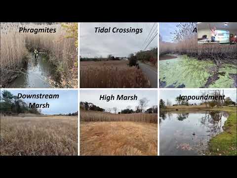
Why it matters: the town’s low-lying Harrison Street crossing is already vulnerable to flooding and, if tidal flow upstream is constrained, marsh habitat could be lost or converted. "This phragmites is 13 feet tall or more," Austin said of stands observed in the upper reach, calling the invasive reed a key indicator of marsh stress and saying the team will test whether culverts or bridge geometry are restricting tidal exchange.
What the team will do: field surveys and monitoring, hydraulic modeling and targeted water-quality sampling. Austin said crews have completed topographic and wetland delineation surveys, will deploy four tide gauges (measuring level, temperature and salinity), and will run computer models of bridge/sluice hydraulics to quantify present and future tidal ranges. He described a water-quality program scheduled for March–May, including wet-weather sampling that will be analyzed for bacteria and nitrogen; phosphorus sampling was mentioned as uncertain.
Community input and local history: several residents described long-standing local practices and features they believe shape current conditions. Attendees said the Amery Dam is managed with removable flashboards (a sluice/sluiceway) and that boards are sometimes removed in spring to allow fish passage; residents also recalled mid-20th-century dredging that may have altered marsh elevations. Local commenters urged staff to consult the Division of Marine Fisheries on fish-passage timing and to incorporate older town studies, including Bay Management Commission monitoring and prior modeling.
Nutrient and infrastructure concerns: participants flagged a shared leach/septic system near Snug Harbor and said substantial groundwater discharge into the Bluefish watershed may carry nutrients. A Bay Management Commission member told the group existing modeling and monitoring show elevated nitrogen at the Bluefish River bridge and encouraged the consultants to use those datasets when developing remediation alternatives.
Next steps: the consultants will analyze monitoring and modeling results and draft restoration alternatives in spring, present findings to the select board in June if recommendations have cost implications, and post the final report publicly on or after June 30. Austin asked stakeholders to add contact information to the sign-in list for targeted follow-up and said the project team will hold additional, broader public meetings as data become available.
Contact: Connor Austin, coastal scientist, Woods Hole Group (email provided at the meeting) said the project will keep residents informed as monitoring and analysis proceed.