Get Full Government Meeting Transcripts, Videos, & Alerts Forever!
Get email alerts on the Erosion Designations topic
No spam. Unsubscribe anytime.
EGLE proposes six high-risk erosion-area designations in Houghton County; public comment open through June 5
Summary
The Michigan Department of Environment, Great Lakes, and Energy presented a 2026 shoreline study proposing six high-risk erosion-area designations covering about 3.1 miles in Houghton County, outlining setbacks (30- and 60-year projections), permitting requirements and a June 5 comment deadline; EGLE staff urged property owners to seek site-specific review.
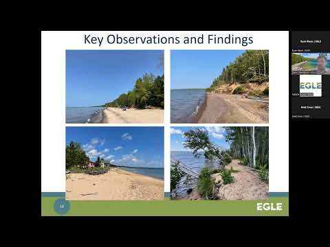
The Michigan Department of Environment, Great Lakes, and Energy (EGLE) on an online public meeting presented a 2026 study that proposes six high‑risk erosion area (HREA) designations totaling about 3.1 miles of Houghton County shoreline and invited written public comment through June 5, 2026.
EGLE Great Lakes shoreland specialist Zach Chamberlain said the department compared historic aerial imagery (late 1970s) to modern photos, verified erosion hazard lines on the ground with GPS, and used USGS’s Digital Shoreline Analysis System (DSAS) and GIS tools to calculate average recession at 150‑foot transect intervals. “The high risk erosion area program was established in 1970 with the passage of Public Act 245,” Chamberlain said, adding that the program is now codified in Part 323 of the Natural Resources and Environmental Protection Act (Public Act 451 of 1994).
The study narrowed focus to roughly 21.7 miles of the county’s 50.6 miles of shoreline and found that three previously designated reaches should remain designated, three previously designated reaches should be de‑designated, and three new reaches meet the HREA criteria. Chamberlain summarized the proposed township outcomes: Stanton Township (two new designations: Area C — avg. recession 1.4 ft/yr, 30‑year setback 55 ft, 60‑year 100 ft; Area D — 1.1 ft/yr, 30‑year 50 ft, 60‑year 80 ft); Hancock Township (Area E showed the highest average recession at 3 ft/yr with 30‑ and 60‑year setbacks of 105 ft and 195 ft; Area F, including shoreline at McLain State Park, averaged 1.6 ft/yr with 30‑year 65 ft and 60‑year 110 ft); Calumet and Schoolcraft townships are proposed for de‑designation; Torch Lake Township continues a prior designation and adds new parcels (Areas G and H with projected 30‑ and 60‑year setbacks ranging roughly 50–125 ft and 80–195 ft depending on parcel).
Chamberlain emphasized what designation triggers for property owners: “An EGLE permit is required for new buildings, additions to existing buildings, and septic systems,” and that an EGLE permit must be obtained before a local building permit in a designated parcel. He explained that designation is intended to inform owners and communities where long‑term erosion could make structures vulnerable and to reduce the need for hardened shorelines.
EGLE staff described the administrative criteria that allow some new houses to be sited closer to shore if they are “readily movable” — for example, a first‑floor foundation area of 3,500 square feet or less (including attached garages and porches) and an attached garage foundation not to exceed 676 square feet — and said larger homes and all septic systems must be sited landward of the 60‑year setback. For parcels too small to meet required setbacks, a special exception (waiver) process exists and staff encouraged property owners to request site‑specific review.
The agency also outlined the permit process and fees: applications are submitted via the MyEnviro portal on michigan.gov/shorelands, EGLE staff have 60 days to act on a completed application, and fees generally range from $50 to $500 (single‑family projects typically $50–$100).
During the meeting, an attendee, Kevin Koskella, expressed concern that recent U.S. Army Corps of Engineers dredging and the angle of a local pier have altered sand movement and increased erosion at his parcel. “It actually swirls and tears the sand out of what was my parcel,” Koskella said, describing studies and local observations. Chamberlain responded that EGLE cannot direct where the Army Corps dredges but that the department reviews dredging projects when possible and tries to encourage beneficial reuse of clean sand; he offered to connect the resident with Marquette district staff who focus on sand‑management issues.
EGLE said it will notify affected landowners by certified mail when designation changes are finalized; the date on that certified letter establishes the effective date of the designation change. Chamberlain said EGLE aims to send certified letters to property owners within six to nine weeks after the agency completes its internal review and processes following the comment period. He also noted he could not authoritatively answer questions about how designation will affect property values or insurance and recommended that owners consult local assessors and insurance providers for those concerns.
Written comments on the Houghton County study or on specific parcels will be accepted until June 5, 2026. Chamberlain provided an email for submissions (chamberlainz@michigan.gov) and a mailing address: EGLE Water Resources Division, PO Box 30458, Lansing, MI 48909‑7958. Staff said the presentation recording will be posted to EGLE’s YouTube channel in the days after the meeting.
Next procedural step: EGLE will review submitted comments, complete internal processing, and mail certified designation letters to property owners; no formal vote or ordinance adoption occurred at the meeting.