Get Full Government Meeting Transcripts, Videos, & Alerts Forever!
Get email alerts on the Land Use Parks topic
No spam. Unsubscribe anytime.
Engineers propose simplified Schaefer Reserve plan; neighbors protest berm, parking and flood risks
Summary
Chester Valley Engineers presented a pared‑down design for the 20‑acre Schaefer Reserve that cuts trails and benches to reduce cost, adds a 16‑space ADA parking lot and proposes berms for screening. Neighbors raised repeated concerns about a 10‑foot berm, parking proximity, stormwater, wetlands mitigation and tree removal during public comment.
Chester Valley Engineers on Monday presented a revised, simplified schematic for the 20‑acre Schaefer Reserve and said they plan to submit permits this spring, but neighbors attending the Bethel Township meeting urged the board to reconsider several elements they called intrusive or risky.
Al Griga, a licensed landscape architect with Chester Valley Engineers, told the Board of Supervisors the new concept keeps a roughly quarter‑mile loop trail but condenses it away from property lines and removes most interconnecting paths to preserve trees. "With this concept we're only removing four live trees," Griga said, adding the team relocated a planned stream crossing to protect a "large 40‑inch sycamore" and adjacent beech grove.
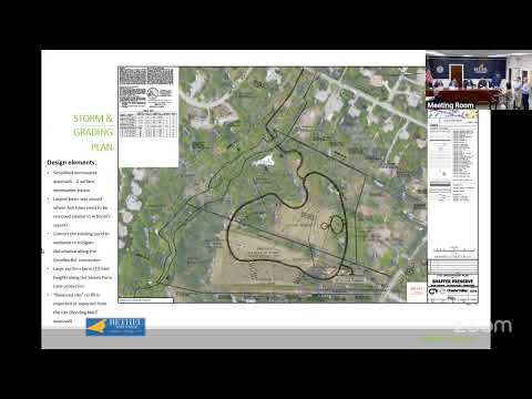
Bob Barnett, the civil engineer on the project, described stormwater changes that prompted much of the redesign. Barnett said infiltration trenches in the earlier Simone Collins plan failed infiltration testing, so the team proposed two surface basins: one adjacent to a 16‑space parking lot and a second basin down‑slope to manage trail runoff. Barnett also said the team plans to convert an existing on‑site pond into permanent wetland mitigation, subject to conservation district approval.
The consultants estimated phase one at about $1 million, covering demolition, bulk grading, tree removal, the parking lot, an asphalt trail, stormwater basins, a 50‑foot bridge and site fixtures. Phase two would add the pavilion, benches, concrete walkway and plantings; those items were not included in the phase‑one figure.
Residents who live along the reserve's boundary voiced sustained opposition during the public‑comment period. One speaker described the prospect of "a 10‑foot wall between a scenic park and our homes," saying a berm of that height would "block that off" and substantially reduce neighbors' views and privacy. Several residents urged smaller berms (three to five feet), additional planting or a privacy fence in lieu of a large earthen berm.
Neighbors also pressed the board on the proposed 16‑space parking lot. "Why is permanent parking needed in the first place?" one resident asked, noting the community had historically used temporary event parking for occasional gatherings. Consultants and a board member responded that grant conditions, ADA access requirements and township insurance concerns drove the need for accessible, on‑site parking. "Anytime you use public funds… your trails have to be accessible," Barnett said, adding PennDOT must also approve any driveway on Beth Road.
Several commenters raised flood‑risk and culvert concerns. Residents near Goodley Road said the creek and upstream culvert routinely back up and worried a bridge and paved trail could be submerged or worsen downstream flooding. Barnett said the bridge would be designed to allow flood flows and that basins are sited to capture runoff at source, but he and presenters acknowledged culvert replacement upstream is a separate, higher‑cost priority under active grant pursuit.
Multiple neighbors asked for greater cost transparency and for side‑by‑side comparisons with the earlier Simone Collins concept, which they said included roughly two miles of trails and 18 benches and had been estimated at about $3 million in prior work. "I want to see what was cut exactly," a resident said. Consultants replied the earlier estimate used different scope and 2024 pricing and that more detailed line‑item estimates will follow the value‑engineering exercise.
Board members acknowledged the strength of public concern and said they would pursue additional neighborhood meetings and refine landscaping to increase buffering between homes and park features before permits are finalized. The consultants said they plan to submit an MPDES application to the Delaware County Conservation District and PennDOT Highway Occupancy and bridge permitting in March and hoped to have permits by the end of September if reviews proceed on schedule.
The meeting closed with the board committing to a follow‑up meeting for HOA/neighborhood stakeholders and further review of berm height, planting buffers and lighting timing; a motion to adjourn carried.
What happens next: the consultants will revise plans based on feedback, seek regulator input on the wetland mitigation proposal and advance permit submissions. The board agreed to consider additional neighborhood engagement before construction drawings are finalized.