Get Full Government Meeting Transcripts, Videos, & Alerts Forever!
Get email alerts on the Zoning Map Updates topic
No spam. Unsubscribe anytime.
Wappinger board reviews townwide zoning map updates; consultant proposes R5A and hamlet mixed‑use corridors
Summary
At a town board workshop, consultants presented a draft zoning map proposing R5A upzoning of many large parcels and expanded hamlet mixed‑use frontages; board members and staff stressed the need to match proposed yields to water, sewer and wetland constraints before any rezoning is finalized.
Supervisor Cavsini opened a special workshop of the Town Board of Wappinger to continue a review of proposed townwide zoning amendments, saying the changes are aimed at making permitted development reflect the realities of the land and the expectations of future residents. He told the board the updates are not tied to a single project but are intended to prevent the repeated creation of lots that later prove impractical because of steep slopes, wetlands, easements and infrastructure limits.
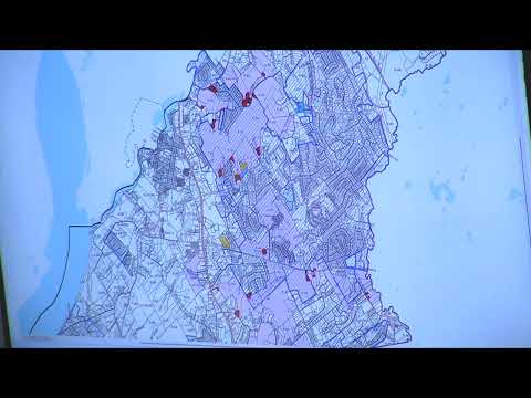
Nicole Allen of the Leburge Group presented the draft map and supporting layers, showing recommended R5A districts (colored purple on the materials) and an expansion of hamlet mixed‑use zones (blue) along corridors such as the Meyers Corners and New Hackinac areas. Allen flagged a handful of smaller parcels (under five acres) shown in red for the board to consider keeping in their original districts or moving to adjacent districts. She said the maps were recently digitized and that some boundary cleanups reflect corrected parcel labels.
Allen walked the board through overlaid water, sewer and wetland maps so members could see why particular parcels are proposed for R5A or hamlet mixed‑use treatment. She said the hamlet approach is intended to preserve front‑facing historic structures for walkable, mixed uses while keeping rear contractor yards and industrial uses in place.
Town staff emphasized the board should adopt a consistent methodology for deciding parcel outcomes. Several board members asked that decisions be tied explicitly to infrastructure availability, wetland delineations and logical connectivity so future determinations can be explained to property owners.
The board did not take any votes on the proposed amendments at the workshop. Planning staff reminded the group that, under state law and local practice, zoning amendments are referred to the planning board and are followed by a public hearing; individual mailed notice to property owners is not required by statute, though the board discussed outreach practices.
The board adjourned after public comments and further discussion; no final action on the zoning map occurred at the meeting.