Get Full Government Meeting Transcripts, Videos, & Alerts Forever!
Get email alerts on the Hillside Ordinance topic
No spam. Unsubscribe anytime.
Cross Plains plan commission recommends reducing one hillside setback from 150 to 100 feet after public hearing
Summary
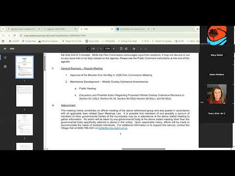
After a public hearing with more than a dozen residents urging protection of bluffs and Black Earth Creek, the Cross Plains Plan Commission voted to recommend the village board change one hillside setback from 150 to 100 feet and approved related ordinance edits while preserving review requirements for other hill protections.
The Cross Plains Plan Commission on June 1 recommended the village board change one part of the village's hillside protection code, reducing the horizontal setback in section 83.125 from 150 feet to 100 feet, after a lengthy public hearing in which residents urged preserving trees, bluffs and water quality.
The recommendation, which the commission forwarded to the village board after a roll-call vote that passed 5-2, followed more than two hours of public comment from residents and representatives of conservation groups who said the village's hills, creeks and trails are community assets. The commission also approved related edits to sections 83.18 and 84.56 (woodland preservation and selective-cutting rules) and sent those changes to the board with recommendations.
Residents and watershed groups framed much of the hearing around erosion, runoff and downstream impacts. "Our hills, creeks, woodlands, and parks are a major draw for residents and visitors," said Jenny Ding of 4005 Creek Side Way, urging the commission to "reject any ordinance changes that would weaken protection for our hillsides and hilltops." Andy Morton, speaking for the Black Earth Creek Watershed Association, described Black Earth Creek as an "outstanding resource" and asked the commission to maintain the village's existing protections to avoid increased sediment and runoff downstream.
Developers of the Marchstone project told the commission the proposal has been under discussion for about two years, that Phase 1 had already installed infiltration controls and that regulatory requirements (village, county and DNR) would be met for stormwater management. The developer representative said they could accept a 100-foot setback in place of an originally proposed 50-foot change.
Commissioners debated two approaches: a project-specific waiver or a villagewide ordinance amendment. Staff explained that a waiver would be considered at final plat and would require a supermajority recommendation from the plan commission and a supermajority vote by the village board, and that waiting for that step could delay the project by months and raise uncertainty. Sonia Crusel, village planner, noted that a Capital Area Regional Planning Commission (CARPC) submission could take about three months and that the DNR would participate in that review.
After discussion the commission made separate recommendations on individual code sections rather than a single up-or-down vote on the full package. The recommendation to change 83.125 (structure setback) from 150 feet to 100 feet carried on a roll-call recommendation vote (Commissioner Hillibbrandt, Trusty Brochious, Commissioner Johnson, Trusty Kettle and President Langfelds voted yes; Commissioner Cree and Commissioner Thus voted no). The commission also recommended the proposed edits to 83.18 (exceptions and oversight for certain hillside activities) and 84.56 (woodland preservation/selective cutting), with edited language that clarifies which positions (existing staff roles such as director of public facilities or parks and recreation) would review particular exceptions and that narrows or clarifies some exemptions.
The record includes several quantitative items commissioners cited while weighing trade-offs: staff and developers displayed maps and tables showing that moving from a 150-foot to a 100-foot setback would reduce the number of buildable lots lost (the materials discussed "about 30.5 lots" lost under a 150-foot requirement versus "13 lots" lost under 100 feet), and the developer said the project's contributions to infrastructure include roughly $5.1 million toward a new reservoir and an estimated $300 million to $400 million increase in taxable value if fully built. A later staff report cited woodland totals for the Marchstone site: total woodland 315.6 acres, proposed removal 125.7 acres (about 39.7%), remaining uncut 190.9 acres and 145.3 acres identified as restorable; that analysis informed edits to section 84.56.
Commissioners and staff took steps to limit the scope of some exemptions in the selective-cutting language, including: removing an automatic allowance for cutting trees under 6-inch diameter at breast height from the non-count list, adding "village-approved ecologist" or "village-approved certified arborist" as the reviewer for certain determinations, clarifying that some required infrastructure (public roads and rights-of-way) should count toward the 30% one-time removal limit while other items (certain utility corridor easements and access routes necessary for infrastructure) could be narrowly exempted, and removing the phrase "not limited to" where it could be read to allow broad interpretation.
The plan commission's recommendations are advisory and will be considered next by the village board, which may accept, modify or reject them. The developer and speakers at the hearing urged different paths forward: multiple residents urged the village to keep the 150-foot standard or grant only project-specific waivers; the developer urged the ordinance be changed to provide greater certainty for the project and said it could accept a 100-foot standard.
The commission adjourned after voting to forward its recommendations to the village board; the board is expected to review the package at an upcoming meeting. The plan commission's record shows robust public engagement and a mix of technical and value-based arguments that the board will need to weigh: water-quality and long-term landscape protection on one side and infrastructure funding and housing/development outcomes on the other.