Get Full Government Meeting Transcripts, Videos, & Alerts Forever!
Get email alerts on the Riparian Buffer topic
No spam. Unsubscribe anytime.
Planning commission reviews draft riparian buffer ordinance, asks staff for refinements before public hearing
Summary
Planning staff presented a draft riparian buffer ordinance proposing two buffer zones (25/50 ft) with a 10‑ft critical zone, prohibitions on impervious surfaces and boathouses, and exemptions for public improvements and approved shoreline stabilization; commissioners requested clarifications and asked staff to return with revisions before a public hearing.
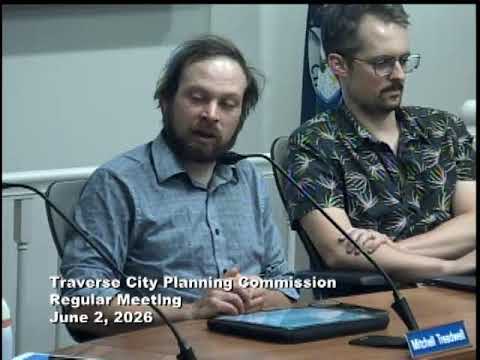
Traverse City planning staff presented a comprehensive draft riparian buffer chapter on June 2 that would create shoreline protection rules for lakes, rivers and creeks across the city, and commissioners asked staff to refine definitions, mapping and public‑property treatment before sending the ordinance to a public hearing.
Planner Leslie summarized committee goals including flood and erosion protection, improved water quality, habitat preservation, preferred native planting lists and location‑sensitive regulations. The draft creates a two‑zone structure: a wider buffer (typically 25 or 50 feet depending on waterbody) and a 10‑foot critical zone nearest the shoreline with far stricter limits. Under the draft, most new impervious surfaces and new boathouses would be prohibited in the buffer; tree removals would be restricted except for limited trimming or approved mitigation plantings. Certain exceptions are proposed for public infrastructure, emergency flood control, publicly funded shoreline stabilization, and projects that secure state permits and an approved native‑landscaping plan.
Staff showed an online map tool to help property owners see where buffers would fall on individual parcels; planners emphasized the map is a planning tool and not the legal standard. Commissioners and commenters pressed staff for clarity about whether public properties (including TCAPS and other publicly‑owned parcels) should be subject to consistent standards, and about coordination with state permitting (the presentation referenced EGLE processes for shoreline stabilization). Commissioners also asked how nonconforming structures and existing improvements would be handled; staff said temporary items and some maintenance activities would not be grandfathered but that long‑standing buildings would retain limited nonconforming rights as under existing zoning law.
Members of the public endorsed the protection goals but raised questions about the ordinance boundary (city limits vs. county), enforcement and whether public projects would be held to similar standards. Staff said enforcement would follow standard zoning enforcement (tickets/fines and compliance opportunities) and noted the city is pursuing grant funds and a multidisciplinary technical team to draft planting lists and companion guidance outside the zoning chapter.
After discussion and public comment, the commission directed staff to return with clarified language, improved mapping accuracy and options for addressing public‑sector projects; commissioners asked to review the revisions with a fuller board before scheduling a public hearing. No formal vote was taken on the ordinance during this meeting.