Get Full Government Meeting Transcripts, Videos, & Alerts Forever!
Get email alerts on the Land Use Subdivision topic
No spam. Unsubscribe anytime.
Applicant presents wetland delineation for 300 Meadow Cross Road; commission discusses buffers, stormwater and trail access
Summary
At a Topsham Conservation Commission meeting the applicant disclosed a May wetland delineation for 300 Meadow Cross Road that showed an extended stream and changed wetland limits; the design was revised to move lots out of wetland swales, and commissioners discussed stormwater ponds, buffers next to farmland and options for trailhead parking and HOA maintenance.
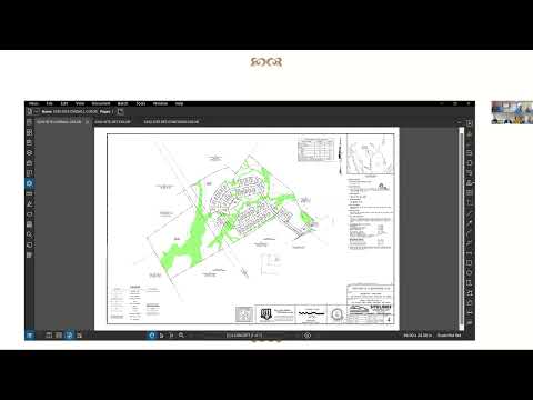
Joe Martin, a civil engineer with Selines representing the applicant, told the Topsham Conservation Commission that a May field delineation found no vernal pools and showed stream and wetland boundaries extending farther than earlier winter sketches.
"There are no vernal pools on the property, so that's great news," Martin said, and described changes to the map that lengthened a stream corridor and altered which lots abut wetlands. He described a redesign that relocates several lots outside mapped wetland swales and preserves a meadow area along the road.
The applicant outlined stormwater approaches for the project: lot-level measures such as roof drip-line filters, and larger systems that could be either underdrain soil filters (that fill and drain within 24–48 hours) or wet ponds with a small permanent pool. Martin said the ponds would capture driveway and roof runoff and route water to treatment areas.
Commissioners and the developer discussed an estimate of wetland impacts. Martin said the project would likely be under the 15,000-square-foot regulatory threshold and "probably somewhere between 10 and 15,000" square feet, which would require compensation under U.S. Army Corps permitting. A numerical fee figure mentioned in the transcript was garbled and could not be verified from the meeting record.
Design trade-offs were a central theme. Participants asked whether lots could be moved farther from the working farmland to the south, and whether flag lots or longer roads would be feasible; the applicant warned that adding lots farther back could trigger road-length limits and raise costs because the site requires two stream crossings. The group discussed a phased approach that would build nearer the road first and defer more costly crossings to a later phase to preserve project financeability.
Commission members pressed on access and public use: one speaker suggested a modest parking area and a short, minimally improved path or bench near a scenic stream spot rather than a full gravel trail. The commission noted the western parcel does not have public access rights and that any trail work or more intensive infrastructure would need HOA cooperation and clear easements.
The meeting record also covered planting and buffer options. Commissioners recommended specifying native or meadow seed mixes for stormwater basins and suggested evergreen plantings along the boundary between future homes and adjacent farmland to reduce future conflicts. The applicant said landscape architects could propose plantings and that selecting native mixes should not change cost materially.
Next steps: Martin said the applicant would address commission and planning-board comments and anticipated submitting preliminary plans to the town in July or August; the commission asked to review preliminary materials before final approvals.
This discussion does not represent a permit decision; the commission did not take a formal vote on the subdivision at this meeting and indicated it will provide comments at preliminary and final plan stages.