Get Full Government Meeting Transcripts, Videos, & Alerts Forever!
Get email alerts on the Historic Preservation topic
No spam. Unsubscribe anytime.
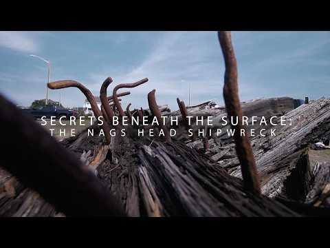
Shipwreck on display at Nags Head Town Hall prompts preservation and identity questions
Summary
Speakers at a presentation described the shipwreck pulled from a Nags Head beach in 1978, debated whether it is the Francis E. Waters or a larger vessel, and outlined modern methods—3D photogrammetry and wood-density testing—to assess preservation needs; no formal preservation plan or funding was announced.
A shipwreck that has sat on public display since it was pulled from a beach in 1978 drew attention at a presentation in Nags Head Town Hall, where speakers discussed its possible identity, condition and the high cost of long-term preservation.
Presenters recounted the wreck’s 1970s history: it washed up along the Outer Banks, at times between Nags Head and Ocracoke, was reported to state underwater archaeology officials and then removed with the help of the Department of Transportation. “It got transferred over here and then it's been out here since 1978,” one presenter said.
The session also reviewed competing clues about the vessel’s identity. The U.S. Life-Saving Service once reported a vessel called the Francis E. Waters found upside down off the coast, and that name “stuck,” a presenter said. But the presenters noted a student’s assignment that compared measured dimensions and timber sizes with historical vessel records; “The Francis E. Waters was about 150 tons, but these timbers are suggesting something much larger, 500 to 900 tons,” the presenter said, indicating the wreck may belong to a different, larger ship.
Presenters described efforts to document the wreck with modern technology. They said researchers used photogrammetry to build 3D models—overlapping photographs taken around the object—to compare a 2016 model (by Dr. Richards and a student) with current models and show how the wreck has changed. “How do you create a 3D model is you have a photography camera and you're walking around… and you're overlapping each photo around the wreck to overlap, so I can create the model,” one presenter explained.
Conservation assessment techniques were also detailed. Speakers described using an IML Resistograph drill to measure wood density: “The density shows us how well preserved or degraded the wood is. If the density's kind of low, the wood's degraded and it's not structurally sound anymore,” a presenter said.
Presenters cautioned that preservation on land carries unique challenges. Unlike submerged timbers that remain waterlogged and are affected by marine borers, a wreck in the sun dries out and can degrade more rapidly. “Recommendations for preservation are really difficult because… you're talking about pretty significant expenses,” a presenter said, adding that at some point a wreck may no longer be feasible to preserve and that managers must weigh costs and historical value.
Speakers framed the site as an opportunity for research and local guidance rather than an item with a ready funding path. They said the work—combining measurements, 3D models and wood-density testing—could inform recommendations for heritage managers and town officials on how to handle similar finds. The presenters emphasized the wreck’s value as a tangible link to the region’s maritime past, stretching from Virginia to the South Carolina border.
No formal preservation plan, funding commitment or ordinance was announced at the presentation. Presenters and an academic conservator from East Carolina University said they were interested in further study and possible conservation options, but left costs and specific next steps for town managers and heritage professionals to determine.