Get Full Government Meeting Transcripts, Videos, & Alerts Forever!
Get email alerts on the Woodside Cpa Rezone topic
No spam. Unsubscribe anytime.
Plan Commission backs land‑use change and rezoning on Woodside Road to allow assisted‑living expansion
Summary
The commission recommended approval of a comp‑plan amendment and rezoning for parcels on the 600 block of Woodside Road so an existing assisted‑living facility can expand onto adjacent acreage; staff said the map label likely missed earlier comp‑plan intent and the commission forwarded both the future‑land‑use change and rezoning to City Council for June 16.
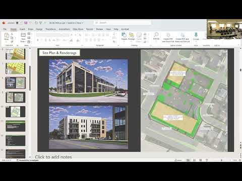
The Green Bay Plan Commission voted June 8 to forward a future land‑use amendment and a related rezoning request for property in the 600 block of Woodside Road to City Council. The changes are intended to allow expansion of an existing assisted‑living facility onto roughly 3.7 acres owned by the Baston family (Baston Family Real Estate LLC).
Staff explained the request grew from an effort to make the comp‑plan map align with the more detailed comp‑plan text: although the map currently labels the parcels low‑density residential, the plan’s narrative and adjacent development patterns call for mixed residential uses and infill appropriate for an assisted‑living campus. Staff recommended changing the future land use from low‑density residential to mixed residential for the identified parcels and requiring a certified survey map to record the amended parcel as a single lot prior to final action.
No members of the public spoke on the item at the public hearing. During the actionable item staff reiterated that creating a single parcel and approving the mixed‑residential designation would allow R3 zoning, which in turn permits assisted‑living as a permitted use on the combined property.
Alder Jim Hutchinson moved to approve the future land‑use amendment; Commissioner Full Wilder seconded. The motion passed and the commission also approved the associated rezoning from R1 to R3 with the condition that a certified survey map be recorded to create a single parcel. Both items were forwarded to City Council for consideration on June 16.
The commission’s recommendations start the municipal process; final land‑use designation and zoning changes will require council action and any required recording of the certified survey map before zoning takes effect.