Get Full Government Meeting Transcripts, Videos, & Alerts Forever!
Get email alerts on the Land Use Development topic
No spam. Unsubscribe anytime.
Planning commission forwards 12‑lot Twin Oaks subdivision to council amid neighbor concerns about drainage, trees and trails
Summary
The Los Gatos Town Planning Commission on June 11 forwarded a recommendation to Town Council to approve a 12‑lot subdivision at 178 Twin Oaks Drive and a recirculated mitigated negative declaration, 4–1, after extended testimony over an ephemeral drainage feature, tree impacts and responsibility for private road and stormwater maintenance.
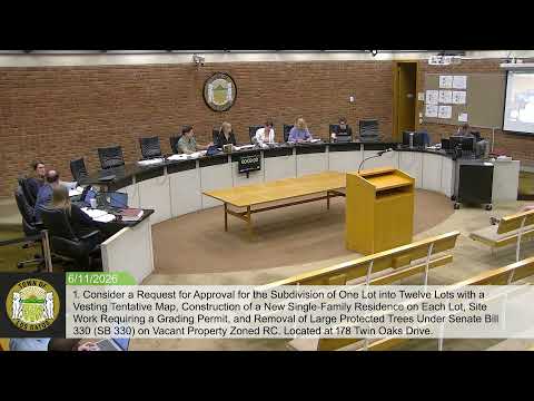
The Los Gatos Town Planning Commission voted 4–1 on June 11 to forward a recommendation to Town Council to approve a 12‑lot subdivision at 178 Twin Oaks Drive, a recirculated Initial Study/Mitigated Negative Declaration (ND‑25‑00001), and related architectural/site applications, subject to revised conditions drafted during the meeting.
The commission’s action came after nearly four hours of staff and consultant presentations, applicant testimony and extensive public comment. Aaron Walters, the town’s senior planner, told commissioners the 17.5‑acre hillside application proposes 12 single‑family lots including three below‑market‑rate units (25 percent of the homes) and is being processed under Senate Bill 330 and state density‑bonus provisions. Walters said the project team recirculated the mitigated negative declaration after consultants identified an ephemeral drainage feature that extends into proposed Lot 5 and added two mitigation measures addressing biological impacts.
Why it matters: Neighbors said the expanded channel mapping, a higher impervious‑area estimate and potential removal of mature trees warrant a fuller environmental review. Opponents urged the commission to require a certified environmental impact report (EIR) before the council acts, while the town’s staff and project consultants said the recirculated MND contains substantial evidence that identified impacts can be mitigated to less‑than‑significant levels with the added measures and with agency permits.
What staff and consultants presented
Senior planner Aaron Walters summarized the project and the recirculated mitigation measures, explaining consultant field work after a storm found a reach of ephemeral channel that extends onto Lot 5. Nick Papani of Rainey Planning and Management said consultants documented roughly 122 linear feet of channel that could be affected and described a mitigation approach based on on‑site restoration and creation of inset channel segments to fully compensate for the impacted channel.
Live Oak Associates’ project biologist and the town’s reviewers said the feature is best characterized as an ephemeral stream (water present only during and shortly after storm events), not a wetland: consultants reported upland species (canary grass, slender oat, filaree), no hydric soils in the pit they examined, and a delineation approach that is subject to agency review. Papani and Rick Hopkins of Live Oak said one‑to‑one linear compensation of channel plus performance‑based revegetation and monitoring is a feasible mitigation approach for ephemeral channels, though final details will be set through permitting with state agencies.
What neighbors told the commission
Dozens of residents — many living directly downhill of the site — urged the commission to require an EIR. Cindy Clark said the 17‑acre proposal would remove a large number of trees and open space while delivering only “three token” below‑market homes. Craig Fordise and other immediate neighbors urged the commission to reconsider Lot 5, which they said is sited above an ephemeral channel and directly behind several homes; they said a larger project footprint and a change in reported impervious surface area (see below) raise doubts about whether prior technical work reflects the current proposal.
Several speakers raised safety concerns, including landslides and fire risk on a steep hillside and construction traffic concentrated on narrow Long Meadow Drive. Jill Ford and others cited a Water Quality Control Board comment that the recirculated MND did not quantify impacts to waters of the state nor unequivocally demonstrate that mitigation is feasible — a point staff and consultants said would be addressed in permitting discussions.
Project team response and technical clarifications
Applicant representatives said they have met with adjacent neighbors, will continue outreach and are willing to consider additional screening and easement options. The project team acknowledged an earlier miscalculation in preliminary submittals that underestimated impervious area; consultants said the hydrology and hydro‑modification analyses were updated to incorporate the corrected disturbance and meet town engineering requirements. Rainey Planning and the town’s engineering review concluded that the modeling and proposed stormwater controls (a combination of permeable pavement on the lower private road, inlets and underground collection, and bioretention/detention areas) address hydro‑modification and water‑quality obligations.
Conditions, CC&Rs and maintenance
Commissioners, staff and public‑works staff spent significant time on how future maintenance will be handled. The commission added and clarified conditions requiring recorded CC&Rs and maintenance agreements that run with the land; a stormwater facilities maintenance agreement; and a private road maintenance agreement to ensure perpetual repair and cost sharing among property owners. Staff recommended, and commissioners adopted as amendments, language requiring maintenance obligations be recorded and enforceable, subject to town‑engineer and town‑attorney review. The commission asked that the CC&R language avoid placing disproportionate perpetual road repair burdens on the below‑market units and that cost‑sharing be proportionate to use when practicable.
Trails and easements
The applicant revised map materials to show public trail reservation(s) and open‑space easements; commissioners instructed staff and the applicant to pursue a pedestrian/bike connection across a short, adjacent parcel where feasible. The commission asked that any gate or connection be designed to allow pedestrian and bicycle access without impeding emergency access and be approved by the town engineer and fire department.
Decision
After deliberations and several condition amendments (including a plant‑palette requirement tied to the town’s hillside planting guidance and exhibit 36, recorded maintenance agreements, and explicit stormwater maintenance language), the commission voted to forward a recommendation of approval to Town Council. The motion passed 4–1. Commissioner Bernett stated on the record that he could not support approval and continued to urge the preparation of an EIR given the project’s technical complexity and the newly mapped channel.
What comes next
The Planning Commission’s action is a recommendation to Town Council; the council will consider the project and the amended conditions. Consultants and staff emphasized that, before any ground‑disturbing activity, required state permits and approvals (for example, Regional Water Quality Control Board/Porter‑Cologne permits and, if applicable, California Department of Fish and Wildlife approvals) must be obtained and that final mitigation language and monitoring will be refined through that agency permitting process.
Notes on claims and numbers cited in the hearing
- The applicant and staff said the site totals roughly 17.5 acres and proposes 12 residential lots with three below‑market units (25 percent). - Consultants reported an estimated 122 lineal feet of ephemeral channel newly identified within the site that crosses or approaches Lot 5 and would be addressed by mitigation measures in the recirculated MND. - Neighbors cited an asserted removal of “225 established trees”; that figure appears in public comment and is treated here as an allegation by neighbors, not an independently verified count conducted by the town’s arborist. - Residents noted an apparent change in reported impervious surface from an earlier submittal figure near 62,000 sq ft to a later figure near 90,000–97,000 sq ft; the project team acknowledged earlier miscalculations and said hydro‑modification analyses were updated to reflect the corrected disturbance area.
The Planning Commission’s report and the full administrative record — including the recirculated MND (ND‑25‑00001), mitigation monitoring and reporting program, Rainey and Live Oak technical materials, and the revised map exhibits referenced at the meeting — will be provided to Town Council as part of the referral package.