Get Full Government Meeting Transcripts, Videos, & Alerts Forever!
Get email alerts on the Flood Resilience topic
No spam. Unsubscribe anytime.
Charlotte County unveils vulnerability assessment mapping tidal and storm-surge risks; county plans targeted planning and funding push
Summary
Charlotte County staff and consultants presented a state-funded vulnerability assessment that maps one-foot and three-foot sea-level scenarios, estimates asset and roadway impacts, highlights rising groundwater risks and septic-conversion costs, and outlines next steps for adaptation-area planning and funding.
Charlotte County on Monday presented a state-funded vulnerability assessment that maps current and projected tidal- and storm-driven flooding across the county and identifies critical assets that are most likely to suffer damage.
"For the benefit of those listening at home, again, my name is Brandon Moody, water quality and resiliency manager of Charlotte County," Moody said at the start of the public briefing, introducing project partners and consultants.
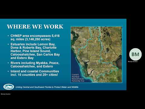
The study, funded in part through a Clean Water Act grant administered by the Coastal and Heartland National Estuary Partnership (CHNP), uses one-foot and three-foot sea-level-change scenarios and modeled storm surges to show how inundation footprints and flood depths change over time. "It's really just flooding and flood protection for today for tomorrow into the future," consultant Mike Flood told attendees, summarizing the assessment's practical focus.
Why it matters: consultants translated mapped flood depths into consequence estimates using FEMA depth–damage curves and repair-time multipliers. The county presentation said the three-foot scenario would put roughly five miles of county roadway underwater and that about 22 percent of county area would be affected at some level by storm surge in the modeled conditions. The analysis produced a ranked inventory of county assets by estimated cost impact to help prioritize investments.
What the assessment found: the team focused on four asset groups—utility infrastructure (water, wastewater, stormwater and power), critical community facilities (schools, hospitals, fire and police), transportation routes (roads and bridges), and natural/cultural resources. Consultants mapped tidal inundation, rising groundwater (identifying areas where groundwater would be within one foot of the surface), and potential wetland conversion to open water. Flood-depth maps show deepest exposure at shorelines and decreasing depth inland.
Costs and household impacts: consultants used FEMA-derived damage relationships to estimate repair costs and downtime; they also noted broader economic impacts such as temporary school closures and business interruptions. During the presentation Mike Flood said septic-to-sewer conversion costs for homeowners are "around I think it's like 19 20,000" per home in the areas targeted for conversion; the county covers a portion of conversion costs, he said.
Partners and data: CHNP's Jennifer Hecker said the partnership provides federal grant funding and technical support, and pointed attendees to CHNP resources such as the regional "water atlas." Consultants credited a University of Florida data contribution and said the county invested in improved modeling to replace lower-quality, large-scale screening tools that can misstate local exposure.
Next steps: county staff said they will refine the inventory by surveying first-floor elevations for county-owned assets, incorporate updated sea-level projections as they become available, and use the refined data to support adaptation-action-area planning, benefit–cost assessments and grant applications. Staff also described recent changes in disaster funding: after a reclassification the county now receives a dedicated allocation of FEMA recovery funds following a disaster declaration, reducing prior competitive barriers.
What remains constrained: staff warned that state-level preemption limits the county's ability to adopt more restrictive local building regulations beyond minimum state standards, and urged residents who want stricter local rules to raise the issue with county commissioners and state legislators.
"We want to make sure that as the county's making investments, it's for us, it's for your kids, it's for their kids to make sure that the community remains viable for a long period of time," a county staff member said in closing, inviting residents to follow up on neighborhood-specific questions.
Ending: County officials emphasized the assessment is a planning-level tool to inform prioritization and grant applications; they described it as the start of a longer planning and implementation sequence rather than a final design for protective projects.