Get Full Government Meeting Transcripts, Videos, & Alerts Forever!
Get email alerts on the Gis Viewer topic
No spam. Unsubscribe anytime.
Knox County demos public GIS viewer for North Haven; board to set launch timeline
Summary
Knox County GIS presented a draft public web viewer for North Haven parcels, zoning, hazards and imagery. The board praised the tool, asked for local conserved‑land layers, and agreed to coordinate launch timing and an update schedule with town staff.
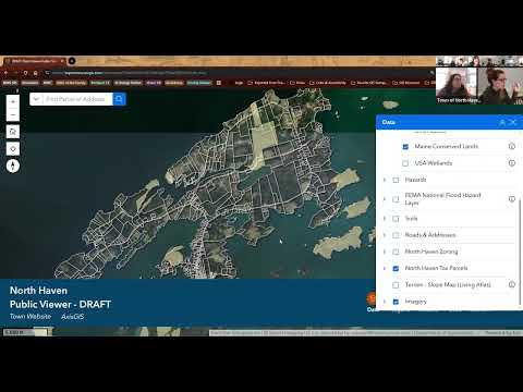
Jaclyn Curtis, acting chair of the North Haven Select Board, invited a Knox County GIS representative to demo a draft public GIS viewer during the board’s Feb. 4 meeting. "This is the draft public viewer. It's a web interface that you can access on your phone or through a web browser," said Leticia Vanurren, who identified herself as the Knox County GIS manager and led the demonstration.
Leticia walked the board through the viewer’s layout and tools, showing parcel searches, E911 address layers, zoning (from the town’s recent ordinance), hazard and resilience layers and historical imagery. She said the primary data sources are state and town government datasets but offered to add additional locally maintained conserved‑land information if the town provides it: "If you send me a list we can incorporate that in," she said when asked about missing local open‑space parcels.
Board members tested parcel popups, flood‑zone overlays and imagery vintages; one member praised the parcel overlay, saying it was "amazing" to see numbers and flood‑zone intersections digitally. Leticia noted the orthophotography shown comes from the Maine GeoLibrary (6‑inch statewide imagery, vintage October 2024) and that the viewer also includes NAIP imagery from prior years.
On maintenance and go‑live timing, Leticia described the viewer as a "living, breathing application" that Knox County will operate with an agreed update schedule: she recommended coordinating with town staff (Rebecca) to set final checks and a launch date. The board emphasized a desire for a simple user FAQ or how‑to and asked staff to follow up on adding local conserved‑land layers and on a launch timeline.
The demonstration concluded with board members encouraging public testing and offering to provide layers and feedback. The Select Board did not take a formal vote on the viewer at the meeting; next steps are for town staff and Knox County GIS to agree an update schedule and a public launch date.