Get Full Government Meeting Transcripts, Videos, & Alerts Forever!
Get email alerts on the Wetlands And Mapping topic
No spam. Unsubscribe anytime.
State planning biologist briefs Baldwin on wetlands maps, vernal pools and Blanding's turtle corridor
Summary
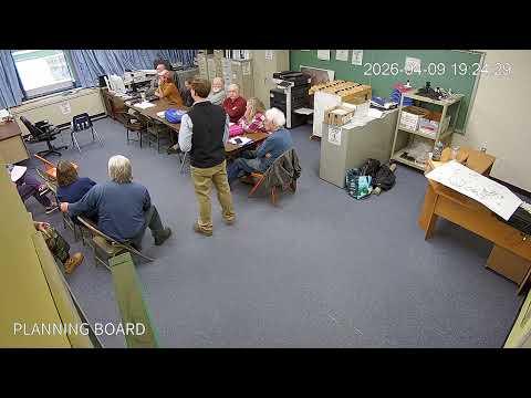
At a Baldwin Planning Board meeting, Beginning with Habitat biologist Gregory Lair explained Maine's wetland definitions, shared three thematic maps for towns, described protection gaps for forested wetlands and vernal pools, and highlighted a proposed Blanding's turtle crossing on Route 113.
Gregory Lair, the state municipal planning biologist with the Beginning with Habitat program, told the Baldwin Planning Board that his team provides free mapping and technical assistance to towns and landowners and urged the board to use the data when updating ordinances and reviewing projects.
"We're not here to tell you what to do. We're just here to give you ideas and give you the information," Lair said, describing the program's free 36'2x36' maps, digital data packages and an interactive map viewer that lets towns create and print custom maps.
Lair outlined a three-map approach offered to municipalities: an aquatics map (wetlands, fisheries, stream and culvert connectivity), a high-value plant and animal habitats map (rare species, significant vernal pools and deer-wintering areas), and a habitat connectivity map that highlights corridors linking natural areas. He showed Baldwin-specific data pulled primarily from the National Wetlands Inventory and Beginning with Habitat's surveys.
A key point for board members was how Maine's legal ("D") definition of freshwater wetlands differs from ecological definitions. Lair said the D definition focuses on aquatic vegetation and, as written, excludes certain water-connected features such as rivers and some shoreland areas that are regulated instead under state shoreland zoning. That distinction is consequential in Baldwin because, board members noted, roughly 80% of local wetlands are forested, and Baldwin's current ordinance language has led to confusion about whether forested wetlands receive the same protections.
Local officials pressed Lair for guidance. He said towns commonly build on the state minimum shoreland rules when they want greater protections, and Beginning with Habitat can provide ordinance language reviews and workshop support.
Lair also summarized permitting triggers: smaller wetlands and impacts under about 4,300 square feet may fall under exemptions, while larger impacts require higher-tier permits or individual review. He urged applicants and consultants to file vernal-pool surveys and the state standard forms so Inland Fisheries & Wildlife can determine whether a pool qualifies as a "significant vernal pool," which triggers added protections.
On species, Lair said Baldwin hosts at least three state-listed dragonfly species and flagged the wood turtle (state special concern) and Blanding's turtle as locally important. He described Blanding's turtles' large movement needs and said Beginning with Habitat has identified a Blanding's turtle corridor crossing Baldwin and a road-mortality hotspot where he hopes to see a DOT crossing installed on Route 113. "If you see any DOT crews putting in a tunnel there this summer, know what's going on," he said, urging landowners to allow surveys or voluntarily pursue habitat conservation measures.
Lair walked the board through culvert assessments shown on the maps: passable culverts are marked differently than impassable or perched culverts, and replacing undersized or impassable culverts can both improve aquatic organism passage and increase road resiliency. He said digital ArcGIS data and PDF maps are available to the town on request.
Board members asked when they should contact Beginning with Habitat. Lair said the program's environmental review team handles project-level reviews; his group focuses on strategic planning, ordinance support and mapping. He offered ordinance-language reviews and follow-up workshops to help the board clarify how local rules should treat forested wetlands, vernal pools and shoreland buffers.
Maps from the presentation will remain available at the meeting, and Lair said the program can email digital datasets on request. He encouraged residents and landowners who are willing to allow on-site surveys or voluntary conservation actions to speak with Beginning with Habitat after the meeting.
The presentation closed with an offer by the program to follow up with ordinance review and to help the board use the maps in the town's comprehensive planning process.