Get Full Government Meeting Transcripts, Videos, & Alerts Forever!
Get email alerts on the Comprehensive Plan Amendments topic
No spam. Unsubscribe anytime.
Monroe Planning Commission advances comprehensive-plan amendments — including Davis urban growth area expansion — to public hearing
Summary
City staff introduced amendments to incorporate Snomish County's expansion of the Davis urban growth area into Monroe's comprehensive plan, propose two map corrections (Smith Brothers and Park Street), and update housing and growth tables; commissioners agreed to send the package to a public hearing for further review.
Monroe Planning Commission members on Monday heard an introductory presentation on a package of 2025—6 amendments to the city's comprehensive plan and agreed to advance the proposals to a planning-commission public hearing.
Staff said the largest component is incorporation of a roughly 23-acre expansion to Monroe's urban growth area (UGA) that Snomish County approved by ordinance; city staff proposes assigning the area a "Residential One" future-land-use designation, which corresponds to the city's R-7 assumptions. "This is just an introduction so no action is requested this evening," Amy said at the start of the discussion.
Why it matters: The amendment would change long-range planning assumptions and update growth-allocation and housing-capacity tables that guide future zoning, infrastructure planning and school capacity decisions. City staff presented updated tables and said the package also includes map corrections for the Smith Brothers property and two parcels along Park Street to better match existing development and ownership.
Key details
- County action and city designation: Staff described Snomish County's prior UGA decision and said the city must incorporate the county's boundary change by assigning a future-land-use designation and updating capacity tables. The county used net-density assumptions (about 4.5 units per acre under its R-9600 assumption); Monroe's proposed Residential One designation aligns to the city's R-7 standards, which treat density on a gross-acre basis and allow up to seven dwelling units per acre for detached housing and up to 14 for attached units.
- Dwelling-unit estimates: The county's buildable-lands method produced an estimate of roughly 75 dwelling units for the expanded area based on its net-density assumptions; city staff applying the R-7 gross-area assumption and a 20% townhome mix produced higher estimates. Kate Turlo, the city's planning manager, explained the arithmetic staff used and said, applying R-7, "you could go from the county's original 75 dwelling units to 124 detached," and with an assumed 20% townhome mix staff's working estimate rose to about "149 dwelling units," which the presentation tied to an estimated population increase to roughly 342 people. Staff said final numbers will be provided in the next packet and will likely fall between those estimates.
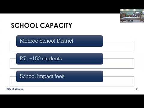
- Schools and fees: The Davis sites are within the Monroe School District. Staff reported current utilization rates of about 88—64% at the elementary and middle school levels and about 87—88% at the high-school level, with five-year projections showing a high-school combined utilization near 104%. Kate Turlo said the district currently is not collecting school impact fees; she summarized the district's process and said the city administers fee collection on the district's behalf if and when the district elects to impose such fees.
- Transportation and utilities: Staff said citywide transportation modeling, when adjusted for estimated peak-hour trips from the Davis area, indicates adequate capacity on the Chain Lake Road corridor but that any future development would require project-level traffic studies and mitigation if impacts are identified. The city's water-system plan and recent wastewater reports were cited as showing adequate capacity through the 2030s; staff emphasized that any development would need project-specific system modeling, utility extensions at the applicant's cost, and payment of system-development charges.
- Map corrections and other amendments: Separate, corrective amendments would redesignate the Smith Brothers property from general commercial back to a residential designation to align with long-standing zoning and on-the-ground use; two parcels on Park Street would be adjusted to avoid creating a nonconforming single-family parcel while retaining city-owned land in mixed-use. Staff said these corrections do not materially change the city's overall land-capacity numbers.
- Development agreement expectations: Staff described planned development-agreement provisions for any annexation or major development of the Davis property, including a multimodal trail extension along Chain Lake Road, a pedestrian connection between 191st and Chain Lake Road, and a requirement for a mix of housing types. Amy said such provisions would be negotiated and recorded as part of the annexation and development-agreement process.
Process and next steps
Staff characterized Monday's presentation as an introduction; commissioners asked clarifying questions and requested additional materials. Staff said it will provide a side-by-side comparison of county and city assumptions and updated packet materials before the public hearing. Commissioners present agreed to move the amendments forward to a planning-commission public hearing and onward to city council following the hearing. The commission earlier approved the June 8, 2026 minutes unanimously.
What's next: Staff will circulate a packet with detailed buildable-lands numbers and modeling assumptions and schedule a planning-commission public hearing; staff said the goal remains to complete the process through city council by the end of July if schedules allow.