Get Full Government Meeting Transcripts, Videos, & Alerts Forever!
Get email alerts on the Forest Management Trails topic
No spam. Unsubscribe anytime.
Richmond advisory committee adopts limits for trail deviations in forest plan
Summary
The Richmond Forest Management Advisory Committee approved a rule limiting trail intrusions into sensitive buffers to a maximum of 5% fragmented area and no more than 20% penetration of buffer width, and directed staff to add diagrams and map clarifications to the draft management plan.
The Richmond Forest Management Advisory Committee voted on Feb. 9 to adopt numeric limits for trail deviations in the town forest management plan, setting a maximum of 5% fragmentation of a buffer's area and a maximum penetration of 20% of the buffer width for any proposed trail deviation.
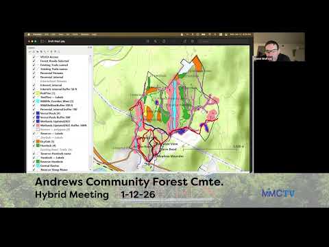
Committee members said the paired limits — one based on area and one on distance — give reviewers a clear, conservative test for whether a proposed trail crossing is unavoidable. Dan, presenting Ian’s map of wildlife corridors, hemlock stands and wetlands, walked members through the map layers and said, "the aqua blue color that runs down the middle of the map, that's the wildlife corridor," to illustrate why limiting incursions matters for connected habitat.
Supporters framed the limits as both protective and practical. "Between the two of these I think it prevents any abuse here," one committee member said during discussion, noting that proposals must still include a written justification, alternatives analysis and ecological review. Brad, who supported the motion, added, "with the other safeguards we've got, I think we'd be in really good shape." Members also emphasized that any deviation would be subject to higher scrutiny than a routine trail approval.
The motion, as recorded in the meeting, proposed the 5% fragmentation-area cap and 20% buffer-penetration cap and was seconded by Sonia. The vote was recorded as in favor by Sam, Sonia, Brad and Dan; the motion passed with those present approving the limits. The minutes and transcript record that the committee is advising the management plan’s language and instructed staff to insert the diagrams that illustrate the two limits into the trail-deviation section.
Beyond the vote, the committee reviewed map detail and editorial changes: members asked that the draft maps show 300-foot buffer visuals for dry oak stands and that winter closures around hemlock stands be spelled out as applying to stands "and the surrounding 300-foot buffer." They also discussed embedding diagrams in the plan near the deviation review steps and agreed to send a finalized map version (John Hen to layout the visual refinements) and a combined ecology/recreation appendix for committee review at the next meeting.
Next steps: staff will insert the agreed diagrams and the minor wording edits, follow up with the TrailForks/Trailfinder outreach training, and return the revised materials to the committee for a final review aimed at compiling the full management plan within the coming weeks; the committee scheduled a follow-up meeting for Feb. 26. The committee also noted that the select board and administrative approvals may be required for some trail projects depending on funding or permitting needs.
Note on sourcing: all factual assertions in this article come from statements made live during the Feb. 9 committee meeting recording and the committee’s on-the-record vote; quotes are direct excerpts from the transcript and attributions use speaker labels available in the meeting record.