Get Full Government Meeting Transcripts, Videos, & Alerts Forever!
Get email alerts on the Tribal Accessibility topic
No spam. Unsubscribe anytime.
SANDAG study finds tribal residents in San Diego region face greater barriers to retailers and health care
Summary
A SANDAG analysis presented on a U.S. Census Bureau LED webinar found tribal nation residents in San Diego County are, on average, farther from essential retailers and health care and experience more convoluted travel routes than similarly remote rural residents; SANDAG highlighted partnerships, grants and data tools to address gaps.
San Diego Association of Governments researchers presented a regional analysis on access to essential services for tribal nations during a U.S. Census Bureau Local Employment Dynamics webinar, finding that tribal residents in several San Diego subregional areas are on average farther from essential retailers and health care facilities than residents of comparable rural communities.
The study, presented by Darren Jiang, a data science intern at SANDAG, compared tribal reservations with similarly remote rural areas using multiple datasets, including U.S. Census Bureau TIGER boundary files, LEHD Origin-Destination Employment Statistics (LODES) version 8.3 (job type 03), SANDAG school inventories, California Health and Human Services Agency facility data and broadband coverage from the California Public Utilities Commission. "We set up a node map based off of the road infrastructure and calculated both direct distance and the shortest trip path to compute an accessibility score," Jiang said.
SANDAG framed the work as an effort to distinguish the effects of remoteness from other factors. Liang Tian, a principal on SANDAG's data science team, said the analysis used census blocks and matched each tribal reservation with comparable rural subregional areas (SRAs) so differences could not be attributed only to distance from urban centers. "If lack of access were only due to distance from urban centers, tribal reservations and their comparable rural communities would show similar patterns—our analysis shows important differences," Tian said.
In the Pauma SRA, home to about 6,500 people and roughly 2,600 housing units, the presenters reported that tribal residents generally have similar commute distances but are typically farther from their nearest essential retailer and health care facility, while being closer to schools. For the Mountain Empire SRA (the transcript records an ambiguous population figure; presenters characterized it as roughly comparable, about 8,000), SANDAG reported tribal residents were, on average, farther from schools and health care and had slightly higher average accessibility scores (tribal average ~0.414; comparable rural average ~0.401).
The study used two distance measures: straight-line (Haversine) distance and shortest-path distance computed on a road network using a bidirectional A* algorithm; an accessibility score was calculated as the ratio of straight-line distance to shortest-path distance to reflect how direct routes are. "The closer to one the score is, the closer the shortest trip path is a straight line," Jiang explained. The presenters cautioned that data coverage can be limited in rural and tribal areas, so specific numeric estimates should be interpreted as indicative rather than exact.
SANDAG also highlighted non-distance factors that affect access. The analysis showed tribal reservations often have less dense road networks and fewer transit stops than nearby rural areas, and broadband coverage—based on CPUC standards—was more often insufficient on tribal lands. SANDAG combined those findings with traffic-safety dashboards and California Highway Patrol data to note higher crash rates for tribal residents when weighted by population and road mileage.
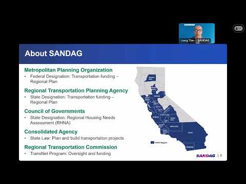
Paula Zamudio, SANDAG senior planner and tribal liaison, placed the research in the context of longstanding SANDAG collaboration with tribes. She noted a government-to-government relationship with the Southern California Tribal Chairman's Association since 2007, recurring working groups and MoUs that inform planning. "Our collaboration helps secure resources: for example, we worked with the Pala Band of Mission Indians to secure a bus route, partnered on a digital equity grant approaching $500,000 to improve internet services for tribes, and are administering a housing program dedicating more than $4 million to advance housing on or near tribal reservations," Zamudio said.
The presenters encouraged use of SANDAG's Open Data portal—hosting traffic safety dashboards, employment-center data and other tools—to support planning and grant applications. The webinar closed with SANDAG staff urging continued partnership and data-sharing while honoring indigenous data sovereignty principles.
The U.S. Census Bureau LED team said the webinar recording and supplemental materials will be posted to the Census Academy site within 30 business days and invited attendees to submit a post-webinar evaluation. The next LED webinar was announced for June 17 at 1:30 p.m. Eastern time.